
 https://pixabay.com/en/grand-canyon-arizona-tourism-snow-1719771/
18 Inches of Snow Fall on the South Rim
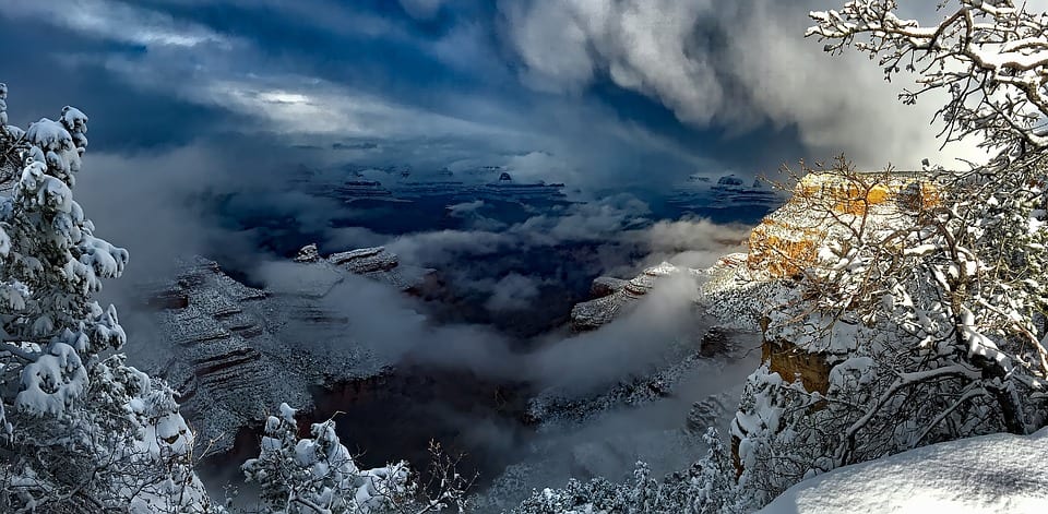
2016 began with a big white wallop for the Grand Canyon as a series of heavy storms dumped about 18 inches of snow on the South Rim between January 4 and January 8. Flagstaff was hit with double that amount—a total of 36 inches of snow fell there. The period of heaviest snowfall in the area was the evening of January 6, when as much as 12 inches accumulated in Williams.
Although the snowfall added an extra element of natural beauty to the Grand Canyon’s already majestic appearance, the heavy snow created some problems for area residents. Schools were forced to close in Flagstaff, Williams, and other cities—some for the entire week. Also closed at certain times during the snowy week were Flagstaff Pulliam Airport, Flagstaff Mall, Northern Arizona University, Coconimo Community College, Bearizona Wildlife Park, and the Williams office of Arizona Public Services. Employees of both Grand Canyon National Park and Kaibab National Forest were allowed to leave work early, and some parts of the park, including Desert View and Hermit’s Rest, were temporarily closed. Power outages affected several homes and businesses throughout the area.
Traveling was made difficult by the daily snowstorms, with numerous minor collisions and slide-offs on various roads. According to the Arizona Department of Public Safety, however, officers responded to far fewer accident-related calls than during the previous heavy storm, in November. The only major roads that were closed during the storms were part of I-17 south of Flagstaff, I-40 east of Ash Fork, and Lake Mary Road in Flagstaff. The roads were reopened after Department of Transportation crews plowed the snow and spread de-icer.
The rest of 2016 is expected to have more snowstorms—though not necessarily more severe storms—than in a typical year because of the El Niño phenomenon, according to the National Weather Service. In this phenomenon, sea surface warming in the equatorial Pacific Ocean, which occurs every two to seven years, affects weather patterns far from the equator. The periodic El Niños vary in intensity and in their weather effects. Weather forecasters expect the 2015-2016 El Niño to be unusually strong, similar to those of 1997-1998 and 2009-2010. In fact, this year’s El Niño could be one of the strongest on record since 1950.
The powerful El Niño means that back-to-back snowstorms, each with perhaps four or five inches of accumulation, should be fairly common throughout the winter. An above-average snowfall total is expected for the area during this winter because of the weather phenomenon. As of early January, Flagstaff already had a season total of about 58 inches of snow. That’s close to the 62.9 inches of snow that fell during the entire season last year. In addition to more snow, El Niño tends to cause below-average temperatures for the Arizona region. As a result of these weather changes, meteorologists expect an end to the drought that has recently affected central and western Arizona.

 https://pixabay.com/en/grand-canyon-landscape-nature-3223031/