
Grand Canyon Scenic Drives
Ah, the Grand Canyon, a spectacular destination that features a diverse and majestic geological extravaganza.
There is plenty of space to explore considering that the canyon stretches for 277 miles, measures from four to 18 miles in width, and averages a mile in depth. Of course, some of the region can only be seen by foot and by air, but if you carefully plan your adventure, you can see some memorable sites by car.
Covering more than 1.2 million acres, the Grand Canyon consists of raised plateaus, steep-walled canyons, desert basins at lower elevations and forests at higher elevations. Canyon walls provide wide-ranging fossil specimens, a vast array of geological features and rock types, and numerous caves.
Though the Grand Canyon is a desert, it is teeming with plants and wildlife. Cactus and wildflowers dot the riverbanks as well as cool glens with tumbling waterfalls and ferns. Bighorn sheep, mule deer, coyotes, and ringtail cats are sometimes visible along the riverbanks and in tributary canyons. Hawks, golden eagles, falcons, great blue herons and egrets fly overhead.
You never know what you will discover when you explore the roadways around the canyon.
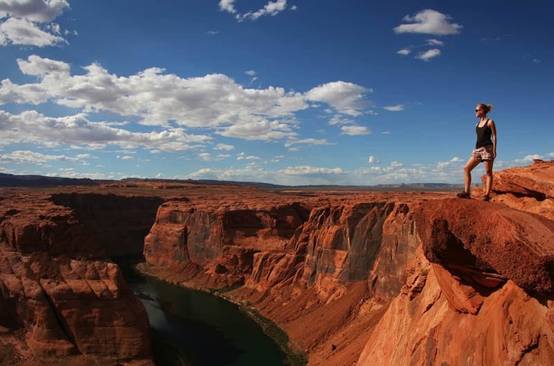
One of the more breathtaking sites you can reach by care of the Toroweap Overlook, which is perched 3,000 vertical feet above the Colorado River.
Looking at the drop is stomach churning, but equally impressive are the volcanic features, cinder cones and lava flows, which make this viewpoint one of the most unique in Grand Canyon National Park. Lava Falls Rapid is a short distance downriver and can be seen and heard from the overlook.
Services here are minimal since the National Park Service strives to maintain the area’s primitive appearance.
To find the Toroweap Overlook, purchase a Bureau of Land Management Arizona Strip Visitor Maps at the Arizona Strip Information Center in St. George, Utah, at nearby Pipe Spring National Monument or at the Kaibab National Forest office in Fredonia, Arizona.
The area can be accessed by car from Arizona Highway 389 near Fredonia, from Colorado City, Arizona or from St. George, Utah.
The Sunshine Route (BLM road #109), which is the primary access route, leaves Highway 389 about seven miles west of Fredonia and six miles east of Pipe Springs, New Mexico. The road is 61 miles long and is the most reliable route.
The Clayhole Route (BLM Road #5) wanders off Highway 389 at Colorado City. It is also about 60 miles long but may be impassable when wet.
The Main Street Route (BLM Roads #1069 and #5) from St. George is around90 miles long and is considered the most scenic route. It may be impassable during winter months because of snow on the slopes of Mt. Trumbull.
Remember, from December through March, all of these roads become muddy and impassable when covered by melting snow. Travel may be possible when the road surface freezes at low temperatures but the roads become impassible once more as the temperature rises.
To learn more about scenic drives and other information about the Grand Canyon, make plans to see the Visitor Center (www.explorethecanyon.com), which is located at the south rim entrance of Grand Canyon National Park. The visitor center serves as a destination and a resource for the most comprehensive selection of information about Grand Canyon area hotels, tours, attractions, restaurants and sightseeing and outdoor activities.
The Visitor Center features a 500-seat IMAX Theater which shows “Grand Canyon: Rivers of Time,” a 2,500-square-foot outfitter store, the famous Condor Encounter Live Bird Show, exhibits and maps, and national park interpretive services and park passes. The facility also includes a 140-seat restaurant, Expeditions sightseeing tours and the Arizona Office of Tourism.

