A Grand Event – Understand the Formation Of The Grand Canyon
The Colorado River with its relentless chisel in hand was the force primarily responsible for creating the diverse topography that is the Grand Canyon today. Slowly but steadily over years of endurance, the Colorado River has cut through the accumulated layers of earth to reach ‘the basement of time’. There is still debate as to the exact timelines that these events took place. The principal consensus among geologists however remains that the Colorado River Basin had come into being in the past 40 million years. A recent study by researchers at the University of Mexico places the Canyon’s origins at 17 million years while earlier estimates place it at 5 to 6 million. Geologic exposures in the Canyon range from the 2 billion old Vishnu Schist to the 230 million year old Kaibab limestone.

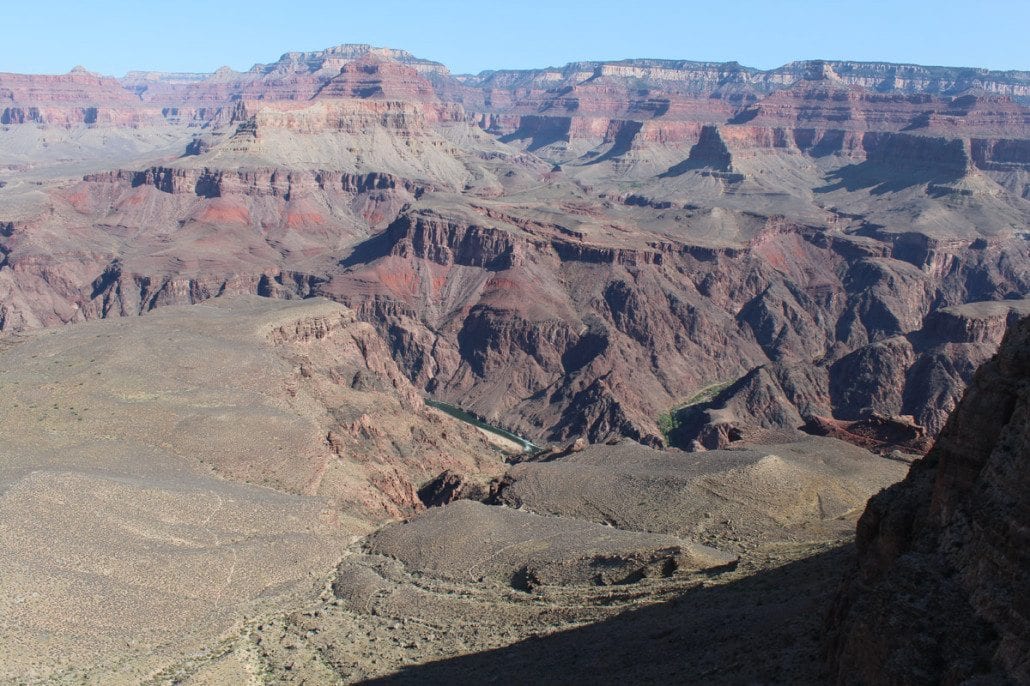
The Colorado River cuts through Grand Canyon
Some of the earth’s oldest rock lies at the bottom of the Grand Canyon and is made up of sediments. Due to shifting earth plates as part of the continental drift phenomenon and other monumental forces, this rock layer was lifted to great height forming a mountain range which was perhaps as tall as the Himalayas. This was around 300 million years after the rock layer had formed. These mountains were, over time eroded into a plane and one billion years ago, a second mountain layer was formed. These mountains too were eroded over time with constant wind, frost and rain action.
The entire region then suddenly sank beneath an inland sea. Primitive shellfish fossilized in large numbers depositing a large layer of shale on top on these ancient rocks. 13,000 feet of sediment and lava were deposited in coastal and shallow marine environments. Ages later, around 65 million years ago (the Laramide Orogeny), the region again raised slowly as a plateau and the Colorado river set to work on it, slowly eroding its way through the top sea bed to ancient rock layer, nearly a mile below the Canyon surface. This uplift of the Colorado plateau actually helped the river and its tributaries to cut down faster.
Ice Ages during the Pleistocene era, increased erosion. With the added precipitation, and subsequently, so did the erosive ability of streams. Flash floods in summer and spring melt water held great amounts of debris which further helped hasten soil erosion.
Volcanic activity in the Uinkaret volcanic field found in the western Grand Canyon region, began around 3 million years ago leading to over 150 outflows of molten basaltic lava. These activities lead to the creation of more than 13 dams along the course of the Colorado. The presence of such dams increased the erosive forces of the river, a fact ably supported by the evidence that the Colorado River has carved a maximum of about 160 feet (49 m) since the demise of these dams.
The Grand Canyon is a veritable paradise for budding Geologists. With over 40 identified rock layers in its 277 mile length, environmental changes can be studied with great detail. Take a Grand Canyon Geology Tour to learn more about the fascinating forces at work behind the formation of the Grand Canyon.