
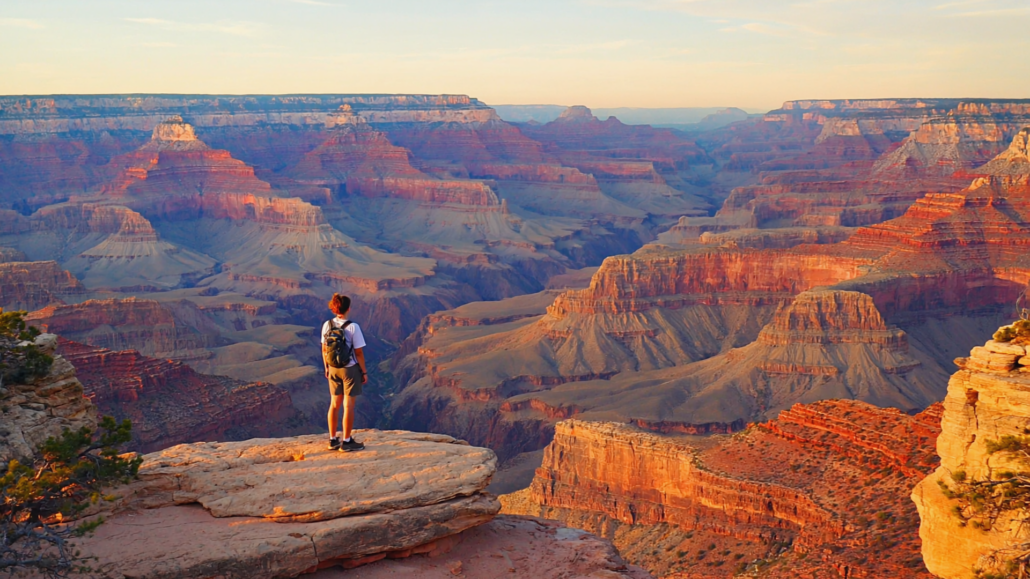
Grand Canyon Hiking Trails Explained: Difficulty Levels, Distances, and What Each Trail Actually Demands
Most first-time Grand Canyon visitors make the same mistake: they look at a trail map, see a distance that sounds manageable, and head straight down. What they don’t account for is the fundamental law of canyon hiking, you go down first, which means the hardest work happens when you’re already tired, dehydrated, and running low on daylight. The trail doesn’t care how fit you are. It cares whether you understood what you signed up for before you took your first step.
This guide breaks down every major trail on the Grand Canyon South Rim with the specificity that trail maps don’t give you. Not just distances and elevation changes, but what the terrain actually feels like underfoot, where most people turn around, what the sun exposure is like at different times of day, and which trails reward casual walkers versus which ones will test experienced hikers. Whether you’re building your first Grand Canyon hiking guide or reassessing what you’ve heard about a specific route, this is the resource that fills the gap between a brochure and a ranger briefing.
Why Canyon Hiking Defies Every Other Trail System You Know
The Grand Canyon inverts the logic of almost every hiking destination in America. On a mountain trail, you climb first and descend when you’re fresh. At the Grand Canyon, gravity pulls you in on the way down, and the brutal climb out waits until you’re fatigued, sun-exposed, and often low on water. This is not a metaphor, it’s the core physical reality that shapes every trail decision you’ll make here.
The National Park Service’s official hiking guidance is explicit about this: the Canyon is not a typical hiking environment, and the most dangerous scenario is not a steep cliff but a slow-developing situation where a hiker descends further than their fitness and water supply can support. Heat, low humidity, and altitude combine in ways that accelerate dehydration far faster than most people expect. The South Rim sits at approximately 6,800 feet in elevation, and the canyon floor near the Colorado River drops to roughly 2,480 feet. That’s more than 4,000 feet of vertical change across some trails.
The practical implication is this: a trail that looks like a 3-mile round trip on paper might take four to six hours and feel like a full-day effort. Trails that seem flat from the rim lookout are anything but once you’re inside. The exposed switchbacks that look picturesque in photographs become furnaces between 10 a.m. and 4 p.m. during summer months, with inner canyon temperatures regularly exceeding 100°F even when the rim feels comfortable.
Understanding this inverted difficulty model before you set foot on any trail is the single most valuable piece of knowledge a Grand Canyon hiker can have. Every section below is written with this framework in mind.
The Rim Trail: Grand Canyon’s Most Accessible Walk
The Grand Canyon Rim Trail is the most forgiving trail in the park, and for a significant portion of its length, it is also paved. This is the trail for families with young children, visitors with mobility considerations, and anyone who wants panoramic canyon views without committing to a descent. It runs approximately 13 miles along the South Rim from Hermits Rest in the west to the South Kaibab Trailhead area in the east, though most visitors walk only a portion of it.
The Rim Trail’s Best Segments
The most popular and visually rewarding section runs roughly 3 miles between Mather Point and Bright Angel Trailhead. This stretch is paved, relatively flat (with some minor undulations), and passes several of the most photographed viewpoints on the South Rim, including Yavapai Point, Yavapai Geology Museum, and Trailview Overlook. This is genuinely one of the finest short walks in the American National Park system, offering unobstructed canyon views with minimal physical demand.
West of Bright Angel Lodge, the trail becomes the Hermit Road corridor, with shuttle bus stops at each major overlook. From March through November, private vehicles are prohibited on Hermit Road, making the shuttle the primary access method. The trail itself continues along the rim between stops, and many visitors combine hiking with shuttle use to customize their distance. The full Hermit Road section adds another 7 miles, and this western portion offers a noticeably less crowded experience than the Village area, particularly at viewpoints like Pima Point and Mohave Point.
The eastern section from Mather Point toward South Kaibab Trailhead is also accessible and connects to the Desert View Drive corridor. This segment tends to draw fewer walkers and offers a quieter rim experience, particularly in the early morning.
What to Know Before You Walk the Rim
Despite its accessibility, the Rim Trail deserves respect. Sun exposure is near-total on most sections, and the edge of the canyon is immediate in places, with limited fencing. Children require close supervision. The elevation at the rim means sun intensity is higher than visitors from lower elevations expect, and dehydration is possible even on a flat walk. Bring water regardless of how short your planned segment is.
For families traveling with strollers or visitors using wheelchairs, the paved village section between Mather Point and Bright Angel Trailhead is the most accessible. The trail becomes unpaved and uneven west of Hermit’s Rest, so check current Grand Canyon trail conditions with park rangers before attempting western rim sections with mobility equipment.
Bright Angel Trail: The South Rim’s Most Famous Descent
The Bright Angel Trail guide conversation always starts the same way: it’s the most popular trail in the park, it’s well-maintained, and it has water available at two rest houses. What visitors often misunderstand is that “most popular” does not mean “easiest.” Bright Angel is the most forgiving of the inner canyon trails, but it is still a serious backcountry experience for anyone attempting more than the first mile.
The trail descends from the South Rim at Bright Angel Trailhead (elevation approximately 6,860 feet) to the Colorado River at Bright Angel Campground and Phantom Ranch (elevation approximately 2,480 feet). The full one-way distance is 9.5 miles with roughly 4,380 feet of elevation change. This is not a day hike for first-timers. For most visitors, the trail is experienced as a partial descent to one of two turnaround points.
The 1.5-Mile Rest House: The Right Turnaround for Most Day Hikers
The first major turnaround point is the 1.5-Mile Resthouse (also called the Mile-and-a-Half Resthouse), reached after a descent of approximately 1,120 feet. The trail to this point involves wide, well-maintained switchbacks and is within reasonable reach for most moderately fit adults. Water is available here seasonally (typically May through September, verify current availability at the trailhead before descending), along with an emergency phone and shade ramadas.
The round trip to the 1.5-Mile Resthouse is 3 miles. In moderate temperatures, this takes most hikers two to three hours. In summer heat, allow significantly longer and start before 7 a.m. The descent itself is not technically difficult, but the return climb on loose, sun-baked rock will feel substantially harder than the descent suggested it would be.
The 3-Mile Rest House: Where the Trail Gets Serious
The 3-Mile Resthouse is the second water and rest point, sitting at an elevation of approximately 4,760 feet, roughly 3,060 feet below the rim. This is the turnaround point recommended by the NPS for strong day hikers. The section between the 1.5-Mile and 3-Mile Rest Houses traverses the inner canyon’s exposed ledges and is noticeably more demanding. The trail narrows in sections, shade becomes scarce, and the heat amplifies dramatically in the warmer months.
A round trip to the 3-Mile Resthouse covers 6 miles and typically takes five to seven hours for fit, experienced hikers in cooler conditions. Attempting this in summer without a very early start is not advised. The NPS consistently posts warnings at this trailhead, and rangers actively turn hikers around who appear under-prepared.
Indian Garden and Beyond
Indian Garden (now formally known as Havasupai Gardens following a name restoration in 2023, though both names appear on current maps) sits approximately 4.6 miles from the trailhead at an elevation of 3,840 feet. It is a genuine oasis with cottonwood trees, year-round water, and a campground. Reaching it as a day hike is possible for well-conditioned hikers who start early and carry adequate water and food. The round trip is 9.2 miles with nearly 3,000 feet of elevation gain on the return. Most hikers who attempt this take six to nine hours.
Below Havasupai Gardens, the trail continues to the Colorado River through Bright Angel Canyon. This section is reserved for backpackers with permits or guests at Phantom Ranch. It should not be attempted as a day hike.
South Kaibab Trail: The Photographer’s Choice, The Hiker’s Test
The South Kaibab Trail is the most visually dramatic trail on the South Rim, and it is also the most demanding for its length. Where Bright Angel descends through a side canyon with intermittent shade, South Kaibab follows a ridgeline directly, offering unobstructed 360-degree views of the canyon at almost every step. The trade-off is that there is no water on the trail, almost no shade, and the descents are steep and unrelenting.
The trailhead sits at approximately 7,260 feet, slightly higher than Bright Angel. The trail drops to the Colorado River at 2,480 feet, covering 6.7 miles one-way with about 4,780 feet of elevation loss. Like Bright Angel, this is typically hiked as a partial descent with a specific turnaround point.
Ooh Aah Point: The Most Rewarding Short Hike in the Park
The first major landmark on South Kaibab is Ooh Aah Point, reached after approximately 0.9 miles and 600 feet of descent. The name is informal but entirely earned. The viewpoint delivers one of the most dramatic open-canyon panoramas accessible to any visitor willing to make a modest physical effort. The trail to Ooh Aah Point is steep but short, and the round trip (1.8 miles) is achievable for most visitors in 45 minutes to 90 minutes.
This is genuinely one of the best hikes Grand Canyon South Rim has to offer for visitors with limited time or moderate fitness. The views here rival anything seen from rim viewpoints, but with the added dimension of canyon depth and scale that only becomes apparent once you’re inside the walls.
Cedar Ridge: The Day Hike Turnaround
Cedar Ridge sits 1.5 miles from the trailhead at approximately 6,120 feet elevation, about 1,140 feet below the rim. It is the recommended turnaround for day hikers on South Kaibab. The ridge is a wide, flat saddle with toilet facilities, shade structures, and mule corrals. The views from Cedar Ridge are exceptional, with the inner canyon fully exposed in multiple directions.
The round trip to Cedar Ridge is 3 miles and typically takes two to three hours in cooler weather. In summer, this hike should be started at or before sunrise, as the trail has essentially no natural shade. Carrying at least two liters of water per person for this hike is the minimum recommendation; more in warmer months.
Skeleton Point and the Colorado River
Skeleton Point, reached at approximately 3 miles from the trailhead, sits at roughly 5,200 feet and offers the first views of the Colorado River from this trail. This is a challenging day hike destination, covering 6 miles round trip with significant elevation change. Only experienced canyon hikers with an early start and full water supply should attempt Skeleton Point as a day hike. The Tonto Platform section between Cedar Ridge and Skeleton Point is exposed, hot, and relentless in warm months.
Hiking to the Colorado River and back via South Kaibab in a single day is strongly discouraged by the NPS except in cooler months, and even then it requires exceptional fitness, planning, and a very early start.
Hermit Trail: The Route for Experienced Hikers Ready to Step Off the Beaten Path
The Hermit Trail represents a significant step up in difficulty and commitment from both Bright Angel and South Kaibab. It is unmaintained below the first mile, receives far less foot traffic, and requires genuine navigation attention. For experienced hikers, this is also one of the most rewarding trail experiences on the South Rim.
The trailhead is at Hermits Rest, the western terminus of Hermit Road, accessible by shuttle bus from March through November (and by private vehicle in winter). The trail descends approximately 4,240 feet over 8.9 miles to Hermit Creek and Hermit Camp. The upper section was improved during the Fred Harvey era in the early 20th century and has better-maintained stonework, but the trail surface becomes rougher and looser below the first mile.
Santa Maria Spring: The Reasonable Day Hike Target
Santa Maria Spring sits approximately 2.5 miles from the trailhead at around 4,040 feet elevation. It is the first water source on the trail, though all backcountry water should be treated before drinking. The round trip to Santa Maria Spring covers 5 miles with roughly 2,000 feet of elevation change. This is a solid half-day hike for experienced hikers and offers canyon solitude that is genuinely hard to find on the more trafficked trails.
The section below Santa Maria Spring descends into the Tonto Platform and connects to a network of inner canyon routes. This territory is for permitted backpackers and experienced canyon hikers only. Day hikers should treat Santa Maria Spring as their turnaround point unless they have significant backcountry experience.
What Makes Hermit Different
Trail conditions on Hermit vary more than on maintained trails. Rock slides occasionally disrupt sections, and the NPS does not repair unmaintained sections. Checking current Grand Canyon trail conditions before hiking Hermit is essential, not optional. The NPS Grand Canyon trail conditions page is updated regularly and should be your last stop before heading to Hermit’s Rest.
Solitude on Hermit is genuine. On busy summer days when Bright Angel sees hundreds of hikers, Hermit may have a handful. This cuts both ways: you’ll have the canyon largely to yourself, but you’re also less likely to encounter other hikers if you need assistance. Hiking Hermit alone without leaving a detailed trip plan with someone reliable is not a practice worth adopting.
Grandview Trail: History, Difficulty, and Honest Conditions
The Grandview Trail is one of the oldest improved trails in the Grand Canyon, originally built in the 1890s to access the Horseshoe Mesa copper mines. It is also one of the steepest trails on the South Rim, with grades that exceed anything found on Bright Angel or South Kaibab in several sections. The stonework from the mining era is still visible and impressive, but the trail is unmaintained and requires careful footing throughout.
The trailhead is at Grandview Point on Desert View Drive, approximately 12 miles east of Grand Canyon Village. The first mile descends approximately 2,600 feet in just over a mile, making the initial pitch steeper than almost anything else on the South Rim. Horseshoe Mesa sits at the end of this steep descent at roughly 4,800 feet, about 2,600 feet below the rim.
Horseshoe Mesa is an extraordinary destination with the ruins of the mining operation, open views in multiple directions, and a rare flat section in the inner canyon. The round trip to the mesa and back is approximately 6 miles with 2,600 feet of elevation change. For hikers accustomed to steep terrain, this is an achievable day hike with an early start. For anyone expecting Grand Canyon trail grades similar to Bright Angel, Grandview will be a shock.
Trails beyond Horseshoe Mesa descend to the Tonto Platform and Horseshoe Mesa campsites, requiring backcountry permits. Day hikers should turn around at the mesa.
Comparing the Major Trails: A Practical Reference
| Trail | Trailhead | Recommended Day Hike Target | Round Trip Distance | Elevation Change | Water On Trail | Difficulty |
|---|---|---|---|---|---|---|
| Rim Trail | Multiple access points along South Rim | Mather Point to Bright Angel Lodge | 3 miles (partial) | Minimal | ✅ Water stations at Village | Easy |
| Bright Angel | Grand Canyon Village | 1.5-Mile Resthouse | 3 miles | ~1,120 ft | ✅ Seasonal (verify) | Moderate |
| Bright Angel | Grand Canyon Village | 3-Mile Resthouse | 6 miles | ~3,060 ft | ✅ Seasonal (verify) | Strenuous |
| South Kaibab | East of Village (shuttle only) | Ooh Aah Point | 1.8 miles | ~600 ft | ❌ No water | Moderate |
| South Kaibab | East of Village (shuttle only) | Cedar Ridge | 3 miles | ~1,140 ft | ❌ No water | Strenuous |
| Hermit Trail | Hermits Rest (shuttle/seasonal) | Santa Maria Spring | 5 miles | ~2,000 ft | ⚠️ Spring (treat all water) | Very Strenuous |
| Grandview Trail | Grandview Point (Desert View Drive) | Horseshoe Mesa | 6 miles | ~2,600 ft | ❌ No reliable water | Very Strenuous |
What First-Timers Consistently Underestimate
Across the South Rim trails, certain patterns repeat themselves. Understanding these before you hike will make your experience significantly safer and more enjoyable.
The Turnaround Time Rule
The most practical piece of advice a ranger will give you: set a turnaround time before you start, not a turnaround point. Turnaround points feel negotiable once you’re on the trail. A time does not. If you decide before you leave that you will begin hiking back at 10:30 a.m. regardless of where you are, you create a constraint that overrides the temptation to push further. This one habit prevents the majority of over-extension incidents on South Rim trails.
The Effort Asymmetry
Descending into the canyon typically requires 30–40% of the total effort of a round trip. The climb back requires the remaining 60–70%. Hikers who feel fine at the bottom are often shocked by how depleted they feel a third of the way back up. This asymmetry is steeper on South Kaibab (because there is no water and the ridgeline offers no shade) than on Bright Angel (which has both). Factor it into your planning by treating the descent as an indicator of roughly half the work ahead.
Sun Timing Is Not Optional
The NPS recommendation to avoid inner canyon hiking between 10 a.m. and 4 p.m. in summer months is not conservative advice for the unprepared. It is accurate advice based on the actual physics of inner canyon temperatures. The rock walls radiate heat, the canyon floor absorbs and re-radiates solar energy, and the combination produces conditions that are measurably more dangerous than temperatures at the rim. The practical implication: summer hikes below the rim should begin at or before sunrise, and you should be back at the rim before 10 a.m. if you’re going to the 1.5-Mile Resthouse, or before noon if you’re doing the 3-Mile Resthouse as an early starter.
Water Is a Load-Bearing Decision
The common rule of thumb for inner canyon hiking is one liter of water per hour of hiking in warm conditions. On South Kaibab, where there is no water on trail at all, this means carrying everything you’ll need for the entire outing. On Bright Angel, seasonal water stations exist but should be treated as a supplement to what you carry, not a reason to bring less. A hydration pack or multiple water bottles is not optional equipment for inner canyon hiking, it is the primary safety system.
Footwear Matters More Than Fitness
Canyon trails are loose, rocky, and uneven in ways that trail running shoes and sandals are not designed to handle. The NPS specifically advises against flip-flops and sandals on inner canyon trails, and the advice is practical, not precautionary. Ankle support on the steep loose sections of South Kaibab and Grandview is genuinely important. Lightweight hiking boots or trail shoes with aggressive grip and ankle support are appropriate for most day hikes; full boots are advisable for Hermit and Grandview.
The Corridor Trails vs. Wilderness Trails Distinction
The NPS designates Bright Angel and South Kaibab as “Corridor Trails”, the two primary maintained routes with ranger patrols, emergency resources, and (on Bright Angel) seasonal water. All other South Rim trails are either “Threshold” or “Wilderness” routes with substantially less infrastructure and support.
This distinction has direct planning implications. On a Corridor Trail, you are more likely to encounter other hikers who can assist in an emergency, more likely to find a ranger during peak hours, and more likely to have access to emergency phones. On Hermit, Grandview, and other wilderness trails, none of these resources are reliably present. The risk calculus for solo hiking or hiking with inexperienced companions shifts meaningfully when you step off the corridor.
For first-time canyon hikers and families with children, the Corridor Trails are the right choice. Experienced hikers comfortable with remote backcountry hiking will find the wilderness trails offer a substantially richer experience of the canyon’s scale and solitude.
Seasonal Trail Conditions: How the Canyon Changes Through the Year
The Grand Canyon is a year-round destination, but trail conditions shift significantly with the seasons, and a trail that is straightforward in October may be genuinely hazardous in the same month under different conditions.
Spring (March through May)
Spring is widely considered the best season for inner canyon hiking. Temperatures are moderate, wildflowers appear in the canyon in April and May, and the light quality for photography is exceptional. Snow can linger on the rim and upper trail sections into April, creating icy conditions on shaded switchbacks. Checking trail conditions before hiking in early spring is particularly important, as ice on the upper Bright Angel or South Kaibab switchbacks requires microspikes or traction devices that most visitors don’t carry.
Summer (June through August)
Summer is the busiest season at the South Rim and the most dangerous for inner canyon hiking. The combination of high visitor volume, extreme heat at lower elevations, and reduced water availability in some years creates conditions that produce the majority of heat-related emergencies in the park. If you visit in summer, confine inner canyon hiking to the early morning hours. The rim trail and viewpoints remain accessible and enjoyable throughout the day. Inner canyon hiking should be reserved for early risers with genuine planning discipline.
Fall (September through November)
September and October represent a second optimal hiking window. Temperatures moderate significantly after Labor Day, crowds thin noticeably after mid-September, and the canyon light in October and November has a quality that photographers specifically plan trips around. The monsoon season (typically July through September) can produce afternoon thunderstorms and flash flooding in side canyons, so check weather forecasts carefully if hiking in September.
Winter (December through February)
Winter hiking at the Grand Canyon is genuinely rewarding and genuinely underrated. The South Rim receives an average of 58 inches of snow annually, and while the rim can be snow-covered, the inner canyon is often accessible and dramatically beautiful with snow on the upper walls. Traction devices are frequently necessary for the upper sections of Bright Angel and South Kaibab from December through February. Visitor numbers are at their annual low, making this the season for hikers who want the canyon largely to themselves. Phantom Ranch reservations are far easier to secure in winter, making overnight trips more accessible for those who’ve been on the waitlist during peak months.
For visitors curious about what the canyon looks like across seasons before committing to a specific hike, watching “Grand Canyon: Rivers of Time” at the Grand Canyon Visitor Center IMAX in Tusayan provides a stunning visual orientation to the canyon’s shifting character through different conditions and light. Located just outside the South Rim entrance gates, it’s the ideal first stop before you decide which trail matches your day.
Planning Your Trail Choice: A Decision Framework
Choosing the right trail is not primarily about fitness level, it’s about matching your available time, water carrying capacity, temperature conditions, and experience with the right combination of distance and turnaround point. Use this framework before every South Rim hike.
Step 1: Check the Temperature and Time of Year
If inner canyon temperatures are projected to exceed 90°F, any hike below the rim requires a pre-sunrise start and a turnaround before 10 a.m. If that constraint doesn’t work with your plans, confine your hike to the Rim Trail and viewpoints. The canyon views from the rim are extraordinary; no hike below the rim is worth a heat emergency.
Step 2: Assess Your Water Carrying Capacity
You need a minimum of two liters of water per person for any hike to the 1.5-Mile Resthouse. For Cedar Ridge on South Kaibab (which has no water), carry at least three liters per person. For the 3-Mile Resthouse, carry three to four liters per person and plan to refill at the rest houses if seasonal water is available. If you cannot carry this volume, shorten your planned hike accordingly.
Step 3: Match Trail to Experience Level
First-time canyon hikers should choose Bright Angel or South Kaibab to Ooh Aah Point. Experienced day hikers comfortable with sustained steep terrain can consider Cedar Ridge on South Kaibab or the 3-Mile Resthouse on Bright Angel. Experienced backcountry hikers with canyon-specific experience should consider Hermit or Grandview for the solitude and challenge they offer.
Step 4: Set Your Turnaround Before You Leave
Write down your turnaround time. Share it with your group. Commit to it. This is the step that most hikers skip and the one that matters most when you’re standing 1,000 feet below the rim feeling great and wondering if you should push a little further.
Getting to the Trailheads: Practical Logistics
Parking at Grand Canyon Village is extremely limited, particularly during peak season. The South Kaibab Trailhead is accessible only by park shuttle (no private vehicle parking), so plan your shuttle timing accordingly. The Bright Angel Trailhead is within walking distance of the main Village parking area and lodges, making it the most logistically straightforward access point.
Hermit Road trailheads (including the Hermit Trail at Hermits Rest) require the park shuttle from March through November. The shuttle runs frequently, but allow extra time at the beginning and end of popular hiking days. Grandview Trailhead at Grandview Point on Desert View Drive does have limited parking, but it fills quickly on summer mornings.
For visitors arriving by car from Tusayan and Highway 64, the Tusayan shuttle offers a practical alternative to driving into the park during peak hours. Shuttles depart from the Tusayan area and connect to the park’s internal shuttle network, reducing parking stress significantly during busy periods.
Visitors who stop at Grand Canyon Visitor Center IMAX in Tusayan before entering the park can also pick up National Park entrance passes on-site, saving time at the entry gate. This is a genuine time-saver on busy mornings when vehicle queues at the South Entrance can extend significantly.
Guided Hiking and Alternative Trail Experiences
For visitors who want expert guidance on the trails, ranger-led programs and guided tour options provide structured experiences that significantly enhance both safety and understanding. The NPS offers free ranger-led walks on the Rim Trail and at various viewpoints throughout the year, with schedules posted at the Grand Canyon Visitor Center inside the park at Grand Canyon Village.
For a guided inner canyon experience, mule trips on the Bright Angel and South Kaibab corridors offer a unique perspective, though they are booked well in advance and have specific weight and height requirements. Phantom Ranch reservations for overnight stays are handled through a lottery system managed by the NPS concessionaire.
Pink Jeep Tours, which operates from Grand Canyon Visitor Center IMAX in Tusayan, provides guided surface exploration of the canyon area for visitors who want an expert-led experience without descending into the canyon. Every Pink Jeep Tour originating from Grand Canyon Visitor Center IMAX includes a ticket to “Grand Canyon: Rivers of Time,” which provides geological and historical context that makes the physical landscape more meaningful when you’re actually standing at the rim. It’s a genuinely useful combination for visitors who want both orientation and adventure.
Frequently Asked Questions About Grand Canyon South Rim Trails
What is the easiest hike at the Grand Canyon South Rim?
The Grand Canyon Rim Trail is the easiest, particularly the paved section between Mather Point and Bright Angel Lodge. It is mostly flat, paved, and accessible to most fitness levels. The 3-mile section through the Village area offers exceptional views with minimal physical demand.
How hard is the Bright Angel Trail for a beginner?
The first 1.5 miles of the Bright Angel Trail to the first rest house is manageable for most healthy adults, but the return climb is harder than the descent suggests. Beginners should start early, carry plenty of water, and commit firmly to turning around at the 1.5-Mile Resthouse rather than pushing further.
Is the South Kaibab Trail harder than Bright Angel?
For equivalent distances, South Kaibab is generally considered more demanding because it has no water on trail, almost no shade, and follows an exposed ridgeline. The views are superior, but the physical conditions are less forgiving. Many experienced visitors hike down South Kaibab and return via Bright Angel (with a shuttle connection) to combine the best of both trails.
Can I hike to the Colorado River and back in one day?
The NPS strongly advises against attempting the rim-to-river round trip as a day hike, particularly in summer. The distance (roughly 19 miles round trip via Bright Angel) and elevation change are beyond most visitors’ capacity for a safe single-day effort. In cooler months, very experienced and well-prepared hikers can attempt it, but it requires permits for the inner canyon areas and careful planning.
What is the best hike for families with young children?
The Rim Trail between Mather Point and Bright Angel Lodge is the best option for families with young children. For families wanting a short inner canyon experience, the first half-mile of the Bright Angel Trail introduces the canyon environment without the full commitment of the descent. Close supervision of children near the canyon edge is essential on all trails.
When is the best time of day to hike in summer?
The NPS recommends hiking below the rim only between dawn and 10 a.m. during summer months. Starting at or before sunrise allows hikers to complete a round trip to the 1.5-Mile Resthouse before temperatures become dangerous in the inner canyon. Rim Trail walking can be done any time but is most comfortable in early morning or evening.
Do I need a permit to day hike at the Grand Canyon?
No permit is required for day hiking on South Rim trails, including Bright Angel, South Kaibab, and the Rim Trail. Overnight backpacking within the canyon requires a backcountry permit, which must be obtained in advance through the NPS Grand Canyon Backcountry Permit system. Permits for popular dates are competitive and should be applied for months in advance.
Is the Hermit Trail suitable for beginners?
No. The Hermit Trail is unmaintained below the first mile, steeper than the corridor trails, and sees significantly less foot traffic and ranger presence. It is appropriate for experienced canyon hikers comfortable with backcountry conditions. First-time Grand Canyon visitors should stick to Bright Angel or South Kaibab.
What shoes should I wear for Grand Canyon hiking?
Lightweight hiking boots or trail running shoes with aggressive grip are appropriate for Bright Angel and South Kaibab. Full ankle-support hiking boots are advisable for Hermit and Grandview, which have rougher, more uneven trail surfaces. Sandals and flip-flops are not appropriate for any inner canyon hiking and are specifically advised against by the NPS.
Are dogs allowed on Grand Canyon South Rim trails?
Dogs are permitted on the Rim Trail on a leash. They are not permitted below the rim on any inner canyon trail at the South Rim, including Bright Angel and South Kaibab. This restriction is enforced. Kenneling options are available in Tusayan if you are traveling with a dog.
What should I carry for a half-day hike to the 1.5-Mile Resthouse?
At minimum: two liters of water per person, salty snacks (electrolytes, not just calories), sun protection (hat, sunscreen, sunglasses), and footwear with good traction. A small first aid kit is advisable. Leave extra layers in the car if hiking in warm months; the inner canyon will be warmer than the rim.
How do I get to the South Kaibab Trailhead?
The South Kaibab Trailhead is accessible only by park shuttle, private vehicle parking is not available at the trailhead. Take the Kaibab/Rim Route (Orange Route) shuttle from the Village area. Shuttles run frequently during peak hours. Allow 15–20 minutes from the Village area to the trailhead by shuttle.
Key Takeaways
- The canyon’s inverted difficulty model is the most important concept to internalize: easy going down means hard going up, always, on every trail.
- Bright Angel Trail is the most appropriate starting point for first-time inner canyon hikers, with the 1.5-Mile Resthouse as the recommended day hike turnaround for most visitors.
- South Kaibab Trail offers the best views-per-effort ratio at Ooh Aah Point (1.8-mile round trip), but carries no water on trail and demands more preparation than it appears.
- The Grand Canyon Rim Trail is genuinely excellent, not just a consolation prize. The paved village section is one of the most scenic easy walks in the US National Park system.
- Hermit and Grandview are for experienced canyon hikers only. Unmaintained surfaces, no water, and limited support make them serious undertakings.
- Seasonal timing affects trail conditions and safety dramatically. Spring and fall are the optimal hiking windows; summer requires dawn starts and firm turnaround discipline.
- Set a turnaround time, not just a turnaround point. Times are non-negotiable; points feel negotiable when you’re standing in the canyon feeling strong.
- Before entering the park, stopping at Grand Canyon Visitor Center IMAX in Tusayan to watch “Grand Canyon: Rivers of Time” on the six-story IMAX screen gives you genuine geological and spatial context that makes every trail decision more informed. You can also pick up National Park entrance passes on-site, saving time at the gate.
The Grand Canyon rewards hikers who prepare honestly and plan conservatively. Every trail described here is worth experiencing, and every one of them will show you something that no photograph or film can fully capture. The key is arriving at the right trail with the right expectations, the right equipment, and the right amount of humility about what the canyon actually demands. Start with the rim, learn the landscape, and let the canyon reveal itself on its own terms.

About the author
Explore The Canyon Editorial Team
See The Canyon
Learn more →

