
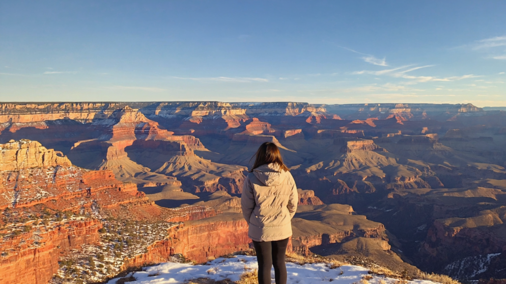
Grand Canyon Microclimate Explained: Why Rim Temperature, Wind Chill, and Inner Canyon Heat Are Three Different Worlds
Most visitors arrive at the South Rim expecting one kind of weather. They check the forecast for Grand Canyon Village, pack accordingly, and head down the trail. What happens next surprises a remarkable number of people: they start sweating through layers they needed an hour ago, the wind that was brutal at the rim has completely disappeared, and the temperature has climbed by 20 or 30 degrees before they reach the first switchback. The Grand Canyon does not operate on a single climate. It operates on at least three, and understanding the difference between them is the most practical piece of knowledge any visitor can carry.
This article breaks down the science behind Grand Canyon weather by season, explains how rim conditions, wind exposure, and inner canyon heat interact to create genuinely separate environments, and gives you a practical framework for planning your visit around the conditions you will actually encounter. Whether you are hiking to the Colorado River, spending a morning at the South Rim viewpoints, or planning a multi-day backpacking trip, the microclimate science here applies directly to your safety, comfort, and enjoyment.
Why the Grand Canyon Has Three Distinct Climate Zones
The Grand Canyon is not simply a hole in the ground. It is a vertical landscape that descends more than a mile from rim to river, and that vertical change creates dramatic shifts in temperature, humidity, wind, and precipitation across a relatively short horizontal distance. The three primary climate zones are the South Rim (around 6,800 feet elevation), the North Rim (around 8,200 feet elevation), and the inner canyon floor near Phantom Ranch (around 2,500 feet elevation). Each zone responds differently to seasonal pressure systems, solar radiation, and moisture.
The mechanism driving these differences is lapse rate, the standard atmospheric principle that air temperature drops by roughly 3.5 degrees Fahrenheit for every 1,000 feet of elevation gain. Applied in reverse, descending into the canyon adds roughly that same increment back with every thousand feet of descent. By the time a hiker reaches the canyon floor from the South Rim, they have effectively traveled the thermal equivalent of several hundred miles south. The Sonoran Desert conditions at the bottom bear almost no resemblance to the cool, pine-forested plateau at the top.
Wind behavior adds another layer of complexity. The South Rim sits on an exposed plateau edge where prevailing winds accelerate along the cliff face. Wind chill at the rim can make a 45-degree morning feel far colder than the thermometer suggests. Drop below the rim by even a few hundred feet, and the canyon walls shelter hikers from that wind almost entirely. The abrupt transition from wind-exposed rim to wind-sheltered inner canyon is one of the most disorienting aspects of the first few minutes on any South Rim trail.
Precipitation patterns diverge along similar lines. The South Rim receives an average of around 15 inches of precipitation annually, with distinct wet seasons in winter and late summer. The inner canyon floor, sitting in a rain shadow created by the surrounding plateau, receives considerably less, with some inner canyon monitoring stations recording closer to 8 inches in a typical year. The North Rim receives the most of all three zones, often exceeding 25 inches annually and accumulating enough snow to require full seasonal closure from mid-November through mid-May.
Grand Canyon Weather by Season: What Each Month Actually Delivers
Grand Canyon weather by season is best understood not as four neat quarters but as a more nuanced cycle of six distinct phases, each with its own character at the rim and its own completely different character inside the canyon.
Winter at the Rim and in the Canyon
Winter at the South Rim is genuinely cold. Daytime high temperatures typically range from the mid-30s to the mid-40s Fahrenheit, with nights regularly dropping below freezing. Snow is common at the rim from November through March, and the accumulated snow on trails creates icy, compacted conditions that require traction devices (microspikes or crampons) on popular routes like the upper Bright Angel and South Kaibab trails. The views in winter are extraordinary. Low-angle winter light produces warm, golden tones on the canyon walls, and clear cold days produce exceptional visibility across the full depth of the canyon.
Inside the canyon in winter, conditions are dramatically milder. Temperatures at Phantom Ranch in January average in the mid-50s during the day, which many experienced hikers consider the most comfortable hiking weather the inner canyon offers all year. The population of hikers drops significantly in winter, trail congestion disappears, and the unique visual experience of seeing snow on the rim while standing in warm, dry air on the canyon floor is something that stops most people in their tracks. Winter is genuinely one of the most underrated seasons for inner canyon travel, provided hikers are prepared for the icy rim sections at the start and end of every descent.
Spring and the Shoulder Season Transition
Spring at the South Rim is highly variable. March and April can deliver anything from snowstorms to genuine warmth, sometimes within the same week. The canyon walls begin warming faster than the plateau as solar angle increases, which means inner canyon temperatures rise quickly through March and April even when the rim still feels cool. By late April, inner canyon daytime highs can push into the 90s on warm days, while the South Rim is still experiencing pleasant 60-degree afternoons.
Spring is also the season of the Grand Canyon’s famous weather inversions. A temperature inversion occurs when warmer air sits above cooler air, trapping a cloud layer inside the canyon while the rim basks in sunshine. These events are visually stunning, producing what looks like a sea of clouds filling the canyon from rim to rim, but they require checking current conditions carefully before descending, since visibility and trail conditions inside an inversion layer can be very different from what the rim appears to promise.
Summer: The Most Dangerous Microclimate Gap
Summer is when the three-climate reality of the Grand Canyon becomes a genuine safety issue. South Rim daytime temperatures in June, July, and August typically range from the mid-60s to the mid-80s, which feels completely manageable to most visitors. Inner canyon temperatures during the same period regularly reach 110 to 115 degrees Fahrenheit. The gap between rim comfort and canyon danger is at its widest between May and September, and it catches visitors who did not understand the microclimate difference.
The National Park Service’s heat safety guidance for Grand Canyon specifically addresses the deceptive nature of summer rim temperatures, warning visitors that the comfortable conditions at the trailhead bear no relationship to what they will experience two hours into a descent. The guidance recommends hiking below the rim only in early morning during summer months, carrying specific minimum water quantities, and turning around at fixed time points regardless of how good a hiker feels at the turnaround point.
The monsoon season, which typically runs from mid-July through September, adds another variable. Afternoon thunderstorms are common and develop rapidly, producing flash flooding in canyon tributaries with very little warning. Rain falling miles away on the plateau can generate a flash flood in a dry streambed with no local precipitation to signal the danger. Checking weather conditions both at the rim and across the broader Colorado Plateau watershed is essential for any canyon hiking during monsoon months.
Fall: The Canyon’s Best-Kept Seasonal Secret
October and November represent the most balanced conditions across all three climate zones. South Rim temperatures settle into the 50s and 60s during the day. Inner canyon temperatures drop from summer extremes into a comfortable 70s-to-80s range. The monsoon ends, trail surfaces dry out, and the cottonwood trees along Bright Angel Creek turn brilliant gold. The crowds that define summer visitation thin considerably after Labor Day, and by mid-October, trail conditions approach their annual best.
Fall is the best time to visit the Grand Canyon for a significant portion of experienced visitors, particularly those planning inner canyon or rim-to-rim hikes. The reduced heat stress, pleasant rim temperatures, and lower trail congestion combine to create conditions that spring and summer rarely match. The one caveat is that early cold snaps can arrive in November, and North Rim facilities begin closing in mid-October before the seasonal road closure in mid-November.
Understanding Grand Canyon South Rim Weather in Detail
Grand Canyon South Rim weather is shaped by the South Rim’s position on the Kaibab Plateau at roughly 6,800 feet above sea level. At that elevation, the South Rim behaves more like a mountain environment than a desert one, which surprises visitors who associate “Arizona” with relentless heat. Summer afternoons are warm but rarely brutal at the rim itself. Winter delivers genuine cold and regular snowfall. The pine and juniper forest that covers the plateau moderates temperature swings compared to the open desert below.
What makes South Rim weather particularly variable is the rim’s exposure to frontal systems moving across the Colorado Plateau. Cold fronts drop temperatures rapidly, often by 20 to 30 degrees in a matter of hours. Wind speeds at the rim edge can exceed 40 mph during these events, and the combination of cold temperatures, wind, and wet trail surfaces creates conditions that demand layered clothing and appropriate footwear even in months that look benign on a temperature chart.
Wind Chill at the Rim: The Invisible Factor
Wind chill is consistently underestimated by South Rim visitors. A morning temperature of 40 degrees with a 25 mph wind produces an effective felt temperature in the mid-20s. At popular viewpoints like Mather Point, Yavapai Point, and the South Kaibab trailhead, there is no natural windbreak between the visitor and the open canyon. Standing at the rim edge on a calm-looking but windy morning without a windproof outer layer is the most common comfort mistake first-time visitors make.
The practical solution is simple but often ignored: always carry a packable windproof shell regardless of the season. It adds almost no weight and transforms an uncomfortable rim visit into a pleasant one. This applies even in June and July, when early morning rim temperatures combined with wind can feel surprisingly cold before the sun reaches full strength.
How Rim Microclimates Vary by Location
Even within the South Rim itself, microclimates vary by position along the rim. The eastern rim viewpoints, including Desert View and Lipan Point, sit slightly lower in elevation and are more exposed to easterly winds. The western viewpoints toward Hermit’s Rest tend to be slightly warmer in afternoon because the canyon walls to the west reflect late-day heat back toward the rim. Shaded sections of the Rim Trail between viewpoints can feel several degrees cooler than open viewpoints, particularly in winter when the canyon walls block direct sunlight for extended portions of the day.
Grand Canyon Trail Conditions: What Changes as You Descend
Grand Canyon trail conditions shift dramatically with depth, and understanding those shifts is essential for planning a safe and enjoyable hike. The upper portions of South Rim trails (the first mile to mile and a half of Bright Angel and South Kaibab) experience conditions most similar to the rim: cold winters with ice, pleasant spring and fall temperatures, and mild summer mornings. Below that transition zone, conditions change progressively toward the inner canyon climate.
Bright Angel Trail Conditions by Depth
The Bright Angel Trail descends approximately 4,380 feet from the South Rim to the Colorado River over 9.5 miles. The trail is divided into rough thirds that correspond loosely to distinct microclimate zones. The upper third, from the rim to Indian Garden (now officially Havasupai Gardens), transitions from rim conditions to mid-canyon conditions, passing through the sheltered Havasupai Gardens oasis at mile 4.6. The presence of year-round water, cottonwood trees, and shade at Havasupai Gardens creates a noticeably cooler microenvironment than the surrounding exposed slopes, making it a critical rest stop in summer.
The lower third, from Havasupai Gardens to the river, drops into full inner canyon conditions. Trail surfaces here are rocky and can be loose in sections, particularly after monsoon rain events. In summer, this section of trail becomes uncomfortably hot by 9 or 10 in the morning and remains dangerous through mid-afternoon. In winter, this section is often free of ice when the upper sections require traction devices, making winter inner canyon hiking more approachable than many visitors expect.
South Kaibab Trail: Exposed Conditions from the First Step
The South Kaibab Trail is more exposed than Bright Angel along its entire length because it follows a ridgeline rather than descending through a sheltered side canyon. That exposure means full sun for most of the day in summer, more intense wind chill in winter, and faster temperature changes as a hiker moves between sun and shadow. The trailhead sits at approximately 7,260 feet, slightly higher than Bright Angel’s rim start, and the trail drops 4,860 feet over 6.4 miles to the Colorado River.
South Kaibab’s exposed ridgeline also means there is no water anywhere on the trail. Hikers must carry all water they need for the descent or plan to resupply at Bright Angel if combining the two trails. This trail is particularly challenging in summer and is not recommended as a round-trip day hike in warm months, but it offers some of the most spectacular views of any trail in the canyon, including unobstructed sightlines across multiple geological layers that the sheltered side-canyon routes never reveal.
How Seasonal Conditions Affect Trail Surface Quality
| Season | Upper Trail (Rim to 1.5 mi) | Mid-Canyon (1.5–5 mi) | Inner Canyon (5 mi to River) |
|---|---|---|---|
| Winter (Dec–Feb) | ⚠️ Ice and packed snow, microspikes required | ⚠️ Patchy ice in shaded sections | ✅ Generally dry and clear, mild temps |
| Spring (Mar–May) | ✅ Variable, check current NPS conditions | ✅ Improving through April | ⚠️ Inner canyon warming rapidly by late April |
| Summer (Jun–Sep) | ✅ Dry, dusty | ⚠️ Hot by mid-morning | ❌ Dangerously hot 9am–5pm; monsoon flash flood risk |
| Fall (Oct–Nov) | ✅ Excellent conditions | ✅ Ideal hiking temperatures | ✅ Best inner canyon conditions of the year |
The Grand Canyon Hiking Guide to Layering and Gear by Season
A practical Grand Canyon hiking guide does not start with trail ratings or mileage charts. It starts with the acknowledgment that you are packing for two or three different climates simultaneously, and the contents of your pack need to reflect that reality rather than the conditions at the trailhead when you start walking.
The Layering Framework for Rim-to-Inner Canyon Hikes
The most effective approach is a three-layer system calibrated for the temperature swing you will experience. The outer layer handles wind and precipitation at the rim and in exposed mid-canyon sections. The middle layer provides insulation for cold rim starts in winter and shoulder seasons. The base layer manages moisture, which matters most in summer when sweat is constant and in winter when wet conditions from rain or melting snow can create hypothermia risk if cotton fabrics are worn next to the skin.
The critical adjustment most hikers fail to make is stripping layers early. The tendency is to keep layers on until you feel warm, then remove them. By that point, you have already been sweating inside your insulation layer, and the moisture will cause significant discomfort on the descent and dangerous chill on the return climb. The correct approach is to remove layers before you feel warm, anticipating the temperature increase that is coming as you descend.
Footwear and the Underestimated Descent Problem
Footwear selection is one of the most consequential decisions for any inner canyon hike. The descent is hard on toes, which impact the front of the shoe with every step down, while the ascent is hard on ankles and calves. A shoe that fits well on flat ground can create severe toenail damage on a 4,000-foot descent if there is not adequate space in the toe box. Trail runners with good grip are widely favored by experienced canyon hikers for their lighter weight and lower heat retention compared to heavy hiking boots, though boots remain appropriate for cold or icy conditions on the upper trail.
In winter, the transition from requiring microspikes on the icy upper section to not needing them on the dry inner canyon requires some planning. Many hikers carry microspikes in a pack pocket, put them on for the first mile or two, and then remove them as the trail surface changes. Attempting the upper sections without traction in winter is the most common cause of rim-trail slips and falls.
Water Planning by Season and Depth
Water requirements change dramatically with season and depth. A cool-weather hiker doing a half-day rim walk may comfortably manage on a single liter. The same person hiking to the Colorado River and back on a June day might require 5 to 6 liters or more, with drinking scheduled on a regular interval rather than waiting for thirst. Thirst is a lagging indicator of dehydration at high temperatures, meaning by the time you feel thirsty in summer canyon conditions, your hydration deficit is already working against your performance and safety.
Bright Angel Trail has water available at the 1.5-mile rest house (seasonal), the 3-mile rest house, and Havasupai Gardens, making it the more practical summer trail for longer hikes. South Kaibab has no water, which is not a meaningful issue in winter but becomes a serious logistical consideration in summer and makes it unsuitable as a summer round-trip route.
North Rim vs. South Rim: Why the Microclimate Difference Matters for Trip Planning
The North Rim is 10 miles from the South Rim as the crow flies, but climatically it is a different world. Sitting roughly 1,400 feet higher than the South Rim, the North Rim receives significantly more precipitation, more snowfall, and experiences earlier and longer cold seasons. The surrounding Kaibab Plateau on the North Rim is covered in dense spruce-fir forest rather than the pine and pinyon of the South Rim, reflecting the higher moisture levels and cooler temperatures at that elevation.
The practical consequence for visitors is that the North Rim is only accessible by road from mid-May to mid-November. The National Park Service’s North Rim visitor information page provides current seasonal access details and closure dates. Visitors who plan a trip assuming the North Rim will be accessible in early May or late November may arrive to find the access road gated. The South Rim, by contrast, is open and accessible year-round, which is one of the reasons it accounts for the large majority of Grand Canyon visitation.
When planning a rim-to-rim hike, the microclimate difference between rims requires careful consideration of the season. Hikers crossing from North to South (the most common direction, as it allows a car shuttle to the South Rim for the return) should check North Rim access dates and North Rim trail conditions independently from South Rim conditions, because a perfectly hikeable South Rim in late October may be paired with challenging early-winter conditions on the North Rim end of the route.
Flash Flooding, Lightning, and the Monsoon Microclimate
The Grand Canyon’s monsoon season introduces a weather dynamic that has no real parallel in most visitors’ home environments. The North American Monsoon, which typically establishes itself over the Southwest between mid-July and mid-September, brings dramatic afternoon thunderstorm activity. These storms develop rapidly over the canyon and surrounding plateau, often producing intense rainfall over limited areas within the broader watershed.
The flash flood hazard in the Grand Canyon is amplified by the canyon’s geology. Bare rock and compacted trail surfaces do not absorb water. Narrow side canyons act as funnels, channeling enormous volumes of runoff into the main canyon tributaries almost instantly. A storm cell sitting 30 miles away over the North Rim can send a wall of water down Bright Angel Creek with no warning at the creek bed itself. The creek can rise from a trickle to a dangerous flood in minutes.
The National Weather Service’s Tucson office, which covers the Grand Canyon region, publishes flash flood watches and warnings that apply to the canyon’s drainage system. Checking this resource in addition to the standard rim weather forecast is essential for any monsoon-season canyon travel. The standard advice is to avoid narrow canyon corridors and creek beds whenever thunderstorm activity is in the forecast for the broader region, not just for the immediate trailhead area.
Lightning is a separate hazard, particularly for the exposed South Kaibab ridgeline and the open South Rim viewpoints. Above-ground metal features, open ridge positions, and proximity to the rim edge all increase lightning risk. Afternoon thunderstorm activity typically peaks between 2 and 5 PM during monsoon months, making early starts and midday turnarounds the standard safety protocol.
The Science of Inner Canyon Heat: Why 115°F Is Not Like 115°F Anywhere Else
The inner canyon’s extreme summer heat has a character that is different from dry desert heat at lower elevations in other contexts, and understanding the difference helps explain why heat-related incidents happen to experienced outdoor travelers who underestimate it.
The inner canyon is a heat trap. The canyon walls absorb solar radiation throughout the day and radiate that stored heat back into the canyon atmosphere, including during the evening hours when the absence of direct sunlight would normally allow temperatures to fall. This radiant heat from rock surfaces adds to the ambient air temperature, creating a combined thermal load that goes beyond what a standard thermometer reading conveys. On a 115-degree afternoon, rock surfaces in the inner canyon can exceed 150 degrees, and the radiant heat from those surfaces affects hikers even when they are in shade.
Humidity, while low in the inner canyon compared to coastal or southeastern environments, increases enough during monsoon periods to meaningfully reduce the body’s evaporative cooling efficiency. Sweat that evaporates quickly in dry conditions stays on the skin longer in humid conditions, reducing its cooling effect and increasing the speed at which core body temperature rises. Hikers accustomed to dry-heat desert environments who visit during monsoon season sometimes find the inner canyon considerably more challenging than their previous experience would suggest.
The elevation gain on the return hike adds a metabolic load to the thermal challenge. Climbing 4,000 feet generates significant internal body heat, which the body must dissipate through sweat at exactly the point when high ambient temperatures are making that dissipation hardest. This combination of metabolic heat production and thermal stress from the environment is why the NPS specifically cautions against attempting rim-to-river round trips in summer, regardless of a hiker’s fitness level.
How to Use the Grand Canyon Visitor Center IMAX as a Trip Planning Baseline
Before any rim or inner canyon visit, getting oriented to the scale and character of the Grand Canyon makes a measurable difference in how prepared and confident visitors feel. Grand Canyon Visitor Center IMAX, located in Tusayan just outside the South Rim entrance, serves exactly that function for hundreds of thousands of visitors each year.
The flagship film, Grand Canyon: Rivers of Time, screens on a six-story IMAX screen using IMAX with Laser technology, and it provides a genuinely useful visual orientation to the canyon’s geology, depth, and character before you walk to the rim for the first time. Understanding the scale of what you are looking at, and having seen the canyon’s geological layers and inner canyon environments on a massive screen, changes how visitors experience the first view from the rim. It is not a substitute for the real thing; it is preparation that makes the real thing richer.
The facility also houses a large souvenir and hiking gear retail store that stocks practical items for rim and inner canyon visits, including the traction devices, sun protection, and hydration supplies that the microclimate realities discussed in this article demand. For visitors who did not pack every layer the canyon requires, this is a practical resource just minutes from the park entrance. Pink Jeep Tours, recognized as Best Tour Operator, operates its office on-site, with guided tours departing from the front door. Every Pink Jeep Tour originating from Grand Canyon Visitor Center IMAX includes a ticket to Grand Canyon: Rivers of Time, which makes the combination a particularly efficient use of limited trip time.
National Park entrance passes are also available for purchase at the facility, which is worth knowing for visitors who prefer to handle that transaction before reaching the park entrance gate. During peak summer months, the Grand Canyon Tusayan shuttle is a practical option for navigating the busy South Rim corridor, and stopping at Grand Canyon Visitor Center IMAX before boarding the shuttle is a natural first step.
Book IMAX online and save on admission, making it easy to lock in your tickets before arriving and avoid any queue at the box office during busy periods.
Planning Your Visit Around the Microclimate: A Decision Framework
The following framework is designed to help visitors match their plans to the actual conditions they will encounter, rather than to the conditions visible at the trailhead when they arrive.
The Three Questions Every Visitor Should Answer Before Hiking Below the Rim
- What is the current inner canyon temperature forecast? Not the South Rim forecast. The inner canyon temperature, available through the NPS Grand Canyon weather page and major weather services with location-specific data for Phantom Ranch, tells you what conditions you will actually hike in at the bottom.
- What time will I be at the hottest point of the trail, and is that timing safe? For summer hikes, being below the rim during peak heat hours (roughly 10 AM to 4 PM) at any depth below the first mile or two should prompt a reconsideration of the plan or an earlier start.
- Do I have the gear for both the rim conditions I start in and the canyon conditions I will reach? Wind shell for the rim, sun protection and sufficient water for the inner canyon, and traction devices if there is any ice possibility on the upper trail.
The Seasonal Visit Decision Matrix
| Visitor Type | Best Season | Good Alternative | Approach with Caution | Not Recommended |
|---|---|---|---|---|
| Rim-only sightseeing | ✅ Any season | ✅ Winter for snow views | ⚠️ Summer midday heat | ❌ None |
| Half-day below-rim hike | ✅ Oct–Nov, Mar–Apr | ✅ Dec–Feb (morning) | ⚠️ May, Sep (early start) | ❌ Jun–Aug midday |
| Rim-to-river day hike | ✅ Oct–Nov | ✅ Dec–Feb (experienced) | ⚠️ Mar–Apr (watch inner canyon temps) | ❌ May–Sep |
| Multi-day backpacking | ✅ Oct–Nov, Mar–Apr | ✅ Dec–Feb (cold-weather gear req.) | ⚠️ Sep (monsoon ending) | ❌ Jun–Aug (extreme heat) |
| Families with young children | ✅ Oct, Mar–Apr | ✅ Nov (mild) | ⚠️ Dec–Feb (icy rim sections) | ❌ Jun–Aug below rim |
| Photography / scenic visits | ✅ Jan–Feb (snow views) | ✅ Oct–Nov (golden light) | ⚠️ Monsoon (dramatic but unpredictable) | ❌ None, every season has value |
What the Canyon’s Geology Tells You About Its Climate
The layered rock walls of the Grand Canyon are not just visually spectacular. They are also a readable record of the environmental forces that shape the canyon’s modern climate. Understanding even the basics of what you are looking at changes how you perceive the weather you are experiencing.
The Kaibab Limestone at the rim represents a shallow marine environment from roughly 270 million years ago. The Coconino Sandstone below it preserves the cross-bedded structure of ancient sand dunes from a desert that existed around 275 million years ago. Deeper still, the Bright Angel Shale and Tonto Platform represent a shallow sea environment from the Cambrian period. Each layer tells a story of a drastically different climate, from tropical ocean to arid desert to ocean again, across hundreds of millions of years.
What this means practically for modern visitors is that the exposed rock types at different depths have different thermal properties. The dense limestone at the rim absorbs and releases heat relatively slowly. The softer shales and sandstones in the mid-canyon heat and cool more rapidly. The ancient Vishnu Schist at the inner gorge, among the oldest exposed rock in North America at roughly 1.7 billion years old, retains heat intensely during summer days and radiates it back at night, contributing to the inner canyon’s elevated nighttime temperatures. You can feel the geological character of the canyon in the air around you, which is something no photograph or film fully captures, though seeing the canyon’s geological layers on a six-story IMAX screen before you walk the trail gives you a useful mental map of what you are walking through.
The article on taking a trip through time at Grand Canyon National Park goes deeper into the geological layers and what each one represents, which is excellent background reading before any visit focused on understanding the canyon’s character rather than simply experiencing its scenery.
Frequently Asked Questions About Grand Canyon Weather and Trail Conditions
What is the temperature difference between the South Rim and the canyon floor?
The temperature difference between the South Rim and the inner canyon floor near Phantom Ranch typically ranges from 20 to 30 degrees Fahrenheit, though in summer the gap can exceed 30 degrees. On a comfortable 75-degree South Rim afternoon in late spring, the inner canyon can be in the mid-100s. This difference is driven by the roughly 4,500-foot elevation change between the two locations.
When is the best time to visit the Grand Canyon for hiking?
October and November are widely regarded as the best months for inner canyon hiking. Temperatures at the canyon floor drop from summer extremes into a comfortable range, trail surfaces are dry and stable, and trail congestion is significantly reduced compared to summer. March and April are also excellent, though inner canyon temperatures rise quickly through April and require more careful timing of hikes by late spring.
Is it safe to hike the Grand Canyon in summer?
Rim-level hiking and viewpoint visits are generally manageable in summer with appropriate sun protection and hydration. Hiking below the rim in summer requires hiking before sunrise and turning around by 10 AM at the latest to avoid the most dangerous inner canyon heat, which regularly exceeds 110 degrees Fahrenheit in June, July, and August. The NPS does not recommend rim-to-river day hikes in summer for any fitness level.
What should I wear hiking the Grand Canyon in winter?
Winter hiking at the Grand Canyon requires microspikes or crampons for the icy upper trail sections (the first one to two miles of Bright Angel and South Kaibab), a windproof outer shell for the exposed rim and upper canyon, and layered insulation that can be removed as you descend into the warmer inner canyon. The inner canyon in winter is often comfortable in lighter layers, making the layering strategy essential rather than optional.
Does the Grand Canyon get snow?
Yes. The South Rim receives regular snowfall from November through March, with heavy snowstorms possible in any of those months. Snow on the rim can be dramatic and beautiful and does not close the park or the rim trails, though it does make upper trail sections icy and slippery. The North Rim receives considerably more snow and closes entirely from mid-November through mid-May.
What causes flash floods in the Grand Canyon?
Flash floods in the Grand Canyon are caused by intense rainfall over the surrounding plateau, particularly during the monsoon season from mid-July through September. Rain falling on the plateau’s bare rock and compacted surfaces runs off almost immediately into canyon drainages, where it is funneled into increasingly narrow corridors. A flash flood can develop in a tributary with no local rain at all if a thunderstorm is occurring miles away over the watershed. Checking broader regional weather conditions, not just the immediate trailhead forecast, is essential during monsoon months.
How does the Grand Canyon weather differ between the South Rim and North Rim?
The North Rim sits approximately 1,400 feet higher than the South Rim and receives considerably more annual precipitation, including significantly more snowfall. The North Rim is cooler in all seasons, has denser forest cover, and experiences earlier and longer cold seasons than the South Rim. It is only accessible by road from mid-May through mid-November. The South Rim is open year-round and is the primary access point for the large majority of Grand Canyon visitors.
What is the Grand Canyon monsoon season, and how does it affect hiking?
The North American Monsoon typically affects the Grand Canyon from mid-July through September, bringing afternoon thunderstorms, lightning, and flash flooding. Hiking in narrow side canyons and creek corridors is particularly hazardous during monsoon season due to flash flood risk. The standard safety approach is to hike early, be out of exposed ridgelines and canyon bottoms by early afternoon, and check both local and regional weather forecasts before any below-rim travel.
Is the Grand Canyon cold at night even in summer?
At the South Rim, summer nights are noticeably cool compared to the daytime, with temperatures often dropping into the 50s overnight even when afternoons reach the low 80s. In the inner canyon, summer nights remain warm, with temperatures at the canyon floor often staying in the 80s or higher through the night, which limits the body’s recovery from daytime heat stress. This is one reason multi-day summer trips in the inner canyon are more demanding than single overnight stays suggest.
Do I need to worry about wind chill at the Grand Canyon in summer?
Wind chill is primarily a cold-weather concern at the Grand Canyon. In summer, the South Rim experiences warm to hot conditions, and wind provides welcome relief rather than a safety concern. The exception is at high elevation viewpoints during afternoon thunderstorms, when rapidly moving air associated with storm development can produce gusty, uncomfortable conditions. In fall, winter, and spring, wind chill at the rim can be significant and should factor into clothing choices.
Can I check Grand Canyon trail conditions before my visit?
Yes. The National Park Service publishes current trail conditions, closures, and seasonal alerts on the Grand Canyon National Park website. Conditions are updated regularly and include information on ice, flooding, construction, and other factors affecting specific trails. Checking this resource within 24 to 48 hours of your planned hike provides the most accurate picture of what you will encounter on the trail.
What wildlife should I watch for on the trails, and does weather affect wildlife behavior?
The Grand Canyon’s wildlife includes mule deer, California condors, ringtail cats, bighorn sheep, and various reptile species. Temperature does affect wildlife activity significantly. Reptiles, including several rattlesnake species, are most active during warm daytime conditions in spring and fall, and less active in winter cold. In summer, many desert animals shift to nocturnal activity to avoid the heat, which is why inner canyon wildlife sightings are more common in early morning and evening hours. The article on Grand Canyon wildlife watching tips covers how to observe canyon wildlife responsibly across all seasons.
Key Takeaways for Grand Canyon Weather and Trail Planning
- The Grand Canyon has three distinct climate zones: the South Rim, the North Rim, and the inner canyon floor. Each responds differently to seasons, and the temperature gap between them can exceed 30 degrees Fahrenheit in any direction.
- Wind chill at the rim is a genuine cold-weather hazard that many visitors underestimate. Always carry a windproof shell regardless of the season.
- Summer is the most dangerous season for below-rim hiking, with inner canyon temperatures regularly exceeding 110 degrees. Hiking before sunrise and turning around by 10 AM is the standard NPS safety guidance for summer canyon travel.
- October and November are the most balanced months for inner canyon hiking, combining comfortable temperatures, dry trails, and reduced crowds.
- The monsoon season (mid-July through September) introduces flash flood and lightning risks that require checking regional weather conditions, not just the trailhead forecast.
- Winter hiking in the inner canyon is more approachable than most visitors assume, with mild conditions at the canyon floor and spectacular winter light at the rim, though icy upper trail sections require traction devices.
- The North Rim closes seasonally from mid-November through mid-May due to snow and road conditions. The South Rim is open year-round.
- Grand Canyon Visitor Center IMAX in Tusayan provides practical hiking gear, park passes, and the IMAX film Grand Canyon: Rivers of Time as an orientation experience before you enter the park. Book IMAX online and save on admission.
- Pack for two or three climates simultaneously on any below-rim hike. The conditions at the trailhead when you start are not the conditions you will experience at the bottom.
- Check the NPS Grand Canyon weather and trail conditions pages within 24 to 48 hours of your planned hike for current, accurate information on the specific conditions you will encounter.

About the author
Explore The Canyon Editorial Team
See The Canyon
Learn more →


Leave a Reply
Want to join the discussion?Feel free to contribute!