
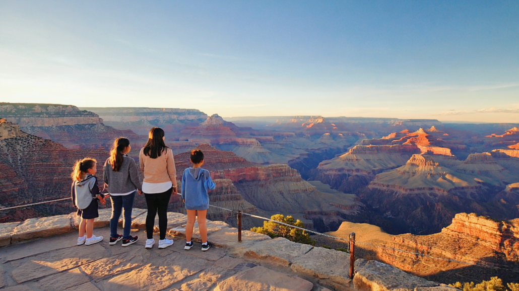
Grand Canyon Trail Difficulty Decoded: What Elevation, Distance, and Exposure Really Mean for Hikers
Most hikers arrive at the Grand Canyon South Rim with a trail name in mind and a vague sense of how far they want to walk. What they rarely have is a clear understanding of what the numbers on the trailhead signs actually demand from their body, and that gap between expectation and reality is where the trouble starts. Elevation change, distance, sun exposure, and water availability interact in ways that make Grand Canyon trails far more demanding than their mileage suggests. A 3-mile hike at the canyon can feel like 9 miles on flat terrain. A trail rated “moderate” by national park standards assumes a level of fitness and heat tolerance that many visitors, especially those arriving from sea level or cooler climates, simply do not have on day one.
This guide breaks down the mechanics of Grand Canyon trail difficulty, not to discourage anyone from hiking, but to give every visitor the clearest possible picture of what they’re signing up for. Whether you’re planning your first descent on the Bright Angel Trail, researching the best hikes Grand Canyon South Rim has to offer for your fitness level, or trying to understand Grand Canyon trail conditions before you book flights, this deep-dive is built to answer the questions the trailhead signs don’t.
Why Grand Canyon Trail Ratings Don’t Work Like Other Parks
Trail difficulty ratings at Grand Canyon National Park follow a different logic than almost any other hiking destination in the United States. At most parks, a “moderate” trail means a reasonable elevation gain, a clear path, and a predictable turnaround point. At the Grand Canyon, the rating system must account for a fundamental reversal of normal hiking physics: you go down first and come back up last, when you’re already tired, dehydrated, and facing the full intensity of midday heat.
The National Park Service’s official Grand Canyon hiking guidance describes this as the “upside-down mountain” problem, and it’s the single most important concept for any hiker to internalize before stepping onto a South Rim trail. When you hike a conventional mountain, you climb first and descend when you’re fresh. At the canyon, the descent feels easy, almost deceptively easy, and lures hikers deeper than they should go. The ascent back to the rim then happens under the worst possible conditions: muscles already fatigued, water supply running low, temperatures at their peak, and full sun exposure on exposed switchbacks.
The Three Compounding Factors That Change Everything
Elevation reversal is the most discussed factor, but it works in combination with two others that receive far less attention. The first is thermal loading: temperatures inside the canyon routinely run 20°F to 30°F hotter than the rim. A pleasant 75°F morning on the South Rim can mean 95°F to 105°F at the Colorado River level, and inner canyon temperatures regularly exceed 110°F during summer months. The second is relative humidity and evaporative deception: the canyon’s desert air is so dry that sweat evaporates almost instantly, masking the rate at which the body is losing fluid. Hikers frequently feel fine right up until they don’t, which is why heat-related illness at the Grand Canyon can escalate quickly and without obvious warning signs.
Together, these three factors, elevation reversal, thermal loading, and low humidity, create a difficulty multiplier that no single trail rating can fully capture. A trail that would rank as “easy” in the Pacific Northwest becomes genuinely strenuous at the Grand Canyon during summer, and “strenuous” trails become potentially dangerous for unprepared hikers. Understanding this multiplier effect is the starting point for every honest Grand Canyon hiking guide.
How NPS Categories Translate in Practice
| NPS Rating | What It Implies | What It Demands at Grand Canyon | Realistic Fitness Level |
|---|---|---|---|
| Easy | Short, minimal elevation, paved or compacted surface | Still involves some descent and return climb; heat remains a factor | Most visitors with proper hydration |
| Moderate | Elevation gain, uneven terrain, longer distance | Significant total elevation change (1,000–3,000 ft), full sun exposure on return | Regular hikers with conditioning |
| Strenuous | High elevation gain, technical terrain, extended duration | 3,000+ ft elevation change, multi-hour exposure, permit or overnight logistics | Experienced backcountry hikers |
| Very Strenuous | Technical, remote, multi-day | Full rim-to-river, route-finding required, extreme heat, emergency response delayed | Highly trained athletes with canyon experience |
Decoding Elevation Gain and Loss: The Numbers That Actually Matter
Elevation change is the most reliable predictor of Grand Canyon trail difficulty, but the way that elevation is structured along a trail matters just as much as the total number. A trail with 1,400 feet of descent concentrated in the first mile is a different physical challenge than one that spreads the same drop across 4.5 miles. Understanding the elevation profile, not just the summary statistic, is what separates an informed hiker from one who gets surprised halfway down.
Reading an Elevation Profile for Canyon Trails
Most trail apps and the NPS website provide elevation profiles for major South Rim corridors. The key things to look for are the rate of descent per mile, the location of the steepest sections, and whether there are any false summits or intermediate plateaus where hikers can rest. At the Bright Angel Trail, for example, the first 1.5 miles to the 1.5-Mile Resthouse drop approximately 1,130 feet, a grade that feels manageable going down but becomes genuinely taxing on the return climb. The section from the 3-Mile Resthouse to Indian Garden (now named Havasupai Gardens) flattens considerably, which is partly why hikers underestimate how much energy they’ve already spent.
The practical rule: for every 1,000 feet of elevation you descend, budget roughly double the time for the ascent, and add more buffer if you’re hiking between 10 AM and 4 PM in warm weather. A descent that takes 45 minutes may require 90 minutes or more to climb, particularly for hikers who haven’t been training at elevation.
How Sea Level Acclimatization Affects Performance
The South Rim sits at approximately 6,860 feet above sea level. For visitors arriving from low-elevation cities, coastal metros, the Gulf states, Florida, the Midwest flatlands, this altitude alone creates measurable cardiovascular strain before a single step of hiking is taken. At elevation, the body delivers less oxygen per breath, which means heart rate climbs faster during exertion, recovery takes longer, and fatigue accumulates more quickly than it would at home. Dehydration also accelerates at altitude due to increased respiratory water loss.
Visitors who fly into Phoenix or Las Vegas and drive directly to the South Rim (a common itinerary) may arrive with 24 hours or less of acclimatization time. That’s rarely enough to fully adjust. The practical implication: plan shorter, lower-intensity hikes on your first day at the rim, regardless of your fitness level at home. Even experienced hikers benefit from an acclimatization day before attempting anything beyond the first major rest stop on a corridor trail.
The Elevation Comparison No One Tells You
Here’s a useful framing exercise: the elevation difference between the South Rim and the Colorado River at Phantom Ranch is approximately 4,460 feet over roughly 9.5 miles via the Bright Angel Trail. That’s equivalent, in raw elevation terms, to hiking from the base to the summit of a modest mountain range, except you do it in reverse, starting at the top. The return trip asks your body to essentially summit that mountain after it has already spent hours hiking in intense heat. No trail difficulty rating communicates this clearly, which is why rim-to-river day hikes are explicitly discouraged by the NPS for the vast majority of visitors.
The Bright Angel Trail Guide: Section by Section
The Bright Angel Trail is the most popular and most forgiving of the main South Rim corridor trails, and for good reason. It has shade in sections, two staffed rest stops with water (available seasonally), emergency phones, and a gradual enough grade that it rewards careful pacing. It is also the trail where the most search-and-rescue operations occur at the Grand Canyon, which underscores the importance of understanding it correctly rather than assuming familiarity equals safety.
Section 1: Trailhead to 1.5-Mile Resthouse (1.5 miles, ~1,130 ft descent)
This is the most accessible section and the appropriate turnaround point for first-time visitors, families with young children, seniors, and anyone unsure of their fitness level. The trail begins at a historic trailhead near Bright Angel Lodge on the South Rim and immediately begins a series of well-maintained switchbacks. The surface is packed gravel and rock, with some sections carved directly through limestone walls. Two short tunnels, carved by early Grand Canyon explorers, add a bit of drama to the opening stretch.
The 1.5-Mile Resthouse offers restrooms, shade structures, an emergency phone, and seasonal water (typically available May through September, though visitors should always confirm current availability before relying on it). This is a genuine turnaround point, not just a waypoint, hikers who stop here and return to the rim will have a satisfying, appropriately challenging experience without pushing into risky territory. Round trip: approximately 3 miles, 2–3 hours for most visitors.
Section 2: 1.5-Mile Resthouse to 3-Mile Resthouse (1.5 miles, ~700 ft additional descent)
The trail between the two resthouses continues downward through progressively older rock layers. The geology here is visually stunning, the color and texture of the canyon walls shift noticeably as you descend through distinct strata. The grade moderates slightly compared to the opening section, but the cumulative elevation loss is starting to build a significant return climb. The 3-Mile Resthouse has restrooms, an emergency phone, and seasonal water. It also has shaded ramadas where hikers can rest before deciding whether to continue.
Reaching the 3-Mile Resthouse and returning to the rim is the recommended maximum day-hike turnaround for fit, prepared hikers during cooler months. Round trip: approximately 6 miles, 4–6 hours. This section should be attempted in warm weather only by hikers who started before 7 AM.
Section 3: 3-Mile Resthouse to Havasupai Gardens (1.5 miles, relatively flat)
This section is deceptive in the best and worst ways. The trail levels out considerably, following a contour that feels like a welcome break after the steep descents above. Havasupai Gardens (historically called Indian Garden) is a genuine oasis, cottonwood trees, flowing water from Garden Creek, and a year-round water station. The landscape here is genuinely unlike anything visible from the rim, and many hikers extend their turnaround to this point for exactly that reason.
The problem is the math: by the time a hiker reaches Havasupai Gardens, they have descended approximately 3,060 feet and covered 4.6 miles from the trailhead. The return trip climbs all 3,060 feet in 4.6 miles. During summer, that ascent happens in full sun with temperatures that can be extreme. This turnaround point is appropriate for experienced hikers starting very early, carrying significant water, and hiking in spring or fall.
Section 4: Havasupai Gardens to Colorado River and Phantom Ranch (4.8 miles, ~1,400 additional ft descent)
This is overnight territory. The NPS explicitly advises against attempting a rim-to-river-and-back trip in a single day, and that guidance is based on the documented pattern of heat illness and rescues that occur when hikers ignore it. Phantom Ranch sits at the canyon floor and is reachable only by foot, mule, or raft. Reservations for lodging and camping at Bright Angel Campground are managed through the NPS lottery system and are highly competitive. Visitors should check the NPS backcountry permit system well in advance for any overnight stay.
Beyond Bright Angel: Understanding the South Rim’s Other Major Trails
The South Rim trail network extends well beyond the Bright Angel corridor, and each trail has a distinct difficulty profile shaped by its geology, sun exposure, water access, and surface conditions. Matching the right trail to the right hiker is one of the most practical things a solid Grand Canyon hiking guide can do.
South Kaibab Trail: High Exposure, Unmatched Views
The South Kaibab Trail is often described as the most scenic day hike at the South Rim, and that reputation is well earned. The trail follows ridge lines rather than drainages, which means panoramic views in every direction, and zero shade. There is no water anywhere on the South Kaibab Trail below the rim. These two facts define the trail’s character completely.
The South Kaibab descends approximately 4,780 feet over 6.7 miles to the Colorado River, making it steeper per mile than the Bright Angel. The surface is often loose shale and rock, particularly in the upper sections, and the ridge-walking nature of the trail means wind exposure in addition to sun exposure. For day hikers, Ooh Aah Point (0.9 miles, ~600 ft descent) and Cedar Ridge (1.5 miles, ~1,140 ft descent) are the appropriate turnaround points. The Skeleton Point turnaround (3 miles, ~2,040 ft descent) is reserved for well-conditioned hikers starting very early in cooler seasons.
Because it has no water and runs fully exposed, the South Kaibab is a better choice for cool-weather mornings than for summer hiking. Many experienced hikers use a combination approach: descend via South Kaibab (for the views), ascend via Bright Angel (for the shade and water stations). The Bright Angel shuttle on the South Rim connects the two trailheads and makes this loop logistically straightforward.
Rim Trail: The Underrated Option for Every Fitness Level
The Rim Trail runs approximately 13 miles along the South Rim between Hermits Rest and the South Kaibab Trailhead, with most sections paved or compacted and accessible to strollers and wheelchairs. It stays at rim elevation, meaning the thermal and elevation challenges of below-rim hiking don’t apply. For families with very young children, visitors with mobility considerations, or anyone who wants to experience the canyon’s scale without below-rim exertion, the Rim Trail delivers extraordinary views with minimal physical risk.
Sections near Mather Point, Yavapai Point, and the Abyss offer some of the most photographed canyon vistas in the world, and the Hermit Road section (accessible by free park shuttle bus, or by bicycle and foot) gives access to overlooks that feel considerably less crowded than the main village area. The Rim Trail is genuinely one of the best hikes Grand Canyon South Rim has for visitors who want to spend several hours outdoors without the heat and exertion of a below-rim descent.
Hermit Trail: For Experienced Hikers Seeking Solitude
The Hermit Trail begins at Hermits Rest, roughly 7 miles west of the main village area on Hermit Road. It’s a non-maintained trail, meaning the NPS does not regularly clear rockfall, improve the surface, or provide water or emergency services below the rim, and it’s significantly less traveled than the corridor trails. That relative solitude, combined with spectacular canyon scenery, makes it a favorite among experienced backcountry hikers.
The trail descends steeply to the Hermit Creek drainage and eventually reaches the Colorado River. Santa Maria Spring, approximately 2.5 miles in, offers a seasonal water source (always filter or treat before drinking). The trail surface is rocky, loose in places, and requires more route-finding than the corridor trails. For day hikers, Santa Maria Spring is a reasonable turnaround, though the return climb is demanding. This trail is not appropriate for first-time canyon hikers or those without prior backcountry experience.
What Grand Canyon Trail Conditions Actually Mean, and How to Check Them
Grand Canyon trail conditions change seasonally, after weather events, and occasionally due to maintenance or emergency situations. Understanding what “conditions” refers to, and knowing where to find accurate, current information, is a practical skill that affects both safety and trip satisfaction.
Seasonal Condition Patterns by Trail
Spring (March through May) brings the most reliable below-rim hiking conditions: temperatures are moderate, water stations are operational or becoming operational, and wildflower blooms in drainage areas add visual drama. The tradeoff is that spring snowmelt can make upper trail sections icy well into April, and sudden afternoon thunderstorms are possible.
Summer (June through August) transforms the inner canyon into an extreme environment. The NPS advises hikers not to hike below the rim between 10 AM and 4 PM during summer months, and this is not a casual suggestion. The combination of reflected heat from canyon walls, direct sun exposure on exposed trails, and the physical demands of the ascent creates conditions that regularly require search-and-rescue operations. Summer hiking is possible but demands very early starts (pre-dawn), large water carries, and conservative turnaround discipline.
Fall (September through November) is widely considered the optimal hiking season. Temperatures moderate, crowds thin after Labor Day, and the light quality in October and November is exceptional for photography. Water stations remain operational through October on the Bright Angel Trail, though hikers should confirm before departing.
Winter (December through February) brings the South Rim’s most dramatic scenery and its least crowded conditions. Snow and ice on upper trail sections are common and require traction devices (microspikes or crampons) for safe travel. Below the rim, inner canyon temperatures are often pleasant, cool enough for comfortable exertion but warm enough to avoid hypothermia risk for prepared hikers. Winter is an underrated season for experienced canyon visitors.
Where to Find Current Trail Condition Information
The NPS maintains updated trail condition reports and any Grand Canyon trail closures on the official park website. Before any below-rim hike, checking the NPS trail conditions and closures page takes less than two minutes and can save significant trouble. Conditions to look for include: water station availability, rockfall or trail damage, permit requirements for specific areas, and any emergency closure notices.
The Backcountry Information Center, located in Grand Canyon Village, is the authoritative in-person resource for trail conditions. Rangers there can provide current reports, answer specific questions about route conditions, and help hikers calibrate their plans to current reality. For visitors arriving before the park, stopping at Grand Canyon Visitor Center IMAX in Tusayan, just outside the South Rim entrance gates, is a practical first step. The facility’s retail store carries hiking gear, and the Pink Jeep Tours team on-site can provide orientation about current conditions and guided options that take the route-planning burden off first-time visitors.
Trail Closure Patterns and What Triggers Them
Grand Canyon trail closures typically fall into three categories: weather-related temporary closures (ice, rockfall, flash flood risk), maintenance closures (trail repair, infrastructure work), and wildlife or resource protection closures (nesting season restrictions, archaeological site protection). Most closures are partial, affecting a specific section of a trail rather than the entire route, and are posted at the trailhead and on the NPS website.
Rockfall is the most common trigger for unplanned closures, particularly on trails that traverse cliff faces or narrow canyon sections. The canyon’s geology is dynamic, freeze-thaw cycles in winter loosen rock, and monsoon moisture accelerates erosion. Hikers who encounter a trail closure sign mid-hike should treat it seriously and turn back rather than attempt to pass around the closure area.
The Exposure Factor: Sun, Heat, and the Physics of Canyon Hiking
Trail ratings rarely capture exposure in a meaningful way, yet exposure is one of the primary determinants of Grand Canyon trail difficulty. In hiking terminology, exposure refers to how much of a trail is open to sun, wind, and the psychological effect of steep drop-offs. At the Grand Canyon, all three dimensions of exposure are present and significant.
Sun Exposure and the Heat Index Trap
The canyon’s orientation, combined with the reflective properties of its pale limestone and sandstone walls, creates a thermal environment that standard weather reports don’t capture. Even on days when the National Weather Service reports relatively moderate temperatures for the region, the inner canyon can be dramatically hotter due to radiant heat from surrounding rock faces. Black or dark-colored rock absorbs and re-radiates heat at a rate that can raise effective temperatures well above the ambient air temperature.
Practical implications: light-colored, breathable clothing matters more than many hikers expect. Sun protection, hat, sunscreen, UV-protective layers, is not optional for below-rim hiking at any time of year. And the orientation of specific trails matters: the South Kaibab’s ridge-line path means it catches sun from all directions and has no shade relief. The Bright Angel’s drainage path gives it periodic shade from canyon walls, particularly in morning hours on the eastern-facing sections.
Wind Exposure and Psychological Exposure on Exposed Ridges
Several Grand Canyon trails involve sections that traverse narrow ridges or cliff-edge paths where the drop-off is significant and immediate. For most hikers, this is a thrilling rather than a limiting factor. For hikers with acrophobia (fear of heights) or limited experience on exposed terrain, it can be a genuine obstacle. The South Kaibab’s ridge-walking sections are the most prominent example, the views are spectacular, but the path is narrow, and the sensation of height is constant.
Wind also becomes a factor on exposed ridge sections, particularly in spring and winter. Strong gusts on the South Kaibab’s upper switchbacks can make footing uncertain, especially on loose shale. Trekking poles improve stability significantly on exposed sections and are worth carrying for any hike below the rim. They’re available for purchase at the Grand Canyon Visitor Center IMAX retail store in Tusayan if you didn’t pack your own.
The Turnaround Decision Framework
One of the most useful tools for any Grand Canyon hiker is a structured approach to the turnaround decision. The canyon’s conditions make it essential to commit to turnaround criteria before starting, not in the moment when emotions, sunk-cost thinking, and peer pressure can override good judgment.
| Turnaround Trigger | What It Means | Action |
|---|---|---|
| Time Rule | You’ve used more than one-third of your total available hiking time on the descent | Turn around now. The ascent always takes longer. |
| Water Rule | You’ve consumed more than half your water before reaching your target | Turn around unless a reliable water source is within reach. |
| Energy Rule | Any member of your group feels fatigued, dizzy, or nauseous | Turn around immediately. These are early heat illness signs. |
| Weather Rule | Thunder, lightning, or darkening skies visible upstream in drainage | Move to high ground immediately. Flash flood risk is real. |
| Clock Rule | It is approaching 10 AM and you are below the first rest stop in summer | Begin ascent. The hottest hours are arriving. |
Matching Hiker Profile to Trail: A Practical Selection Guide
The best hike for any individual isn’t necessarily the most famous one or the one with the most dramatic views, it’s the one that matches their actual fitness level, time available, heat tolerance, and experience with canyon-specific terrain. The following profiles are designed to give hikers a realistic starting point rather than an aspirational one.
First-Time Visitor, General Fitness
Recommended: Rim Trail between Mather Point and Yavapai Point (paved, rim-level, no elevation change), plus a short below-rim descent to the 1.5-Mile Resthouse on Bright Angel Trail (early morning, before 9 AM). This combination gives a genuine canyon experience, above and below the rim, without creating the conditions for heat illness or overexertion. Total active time: 3–4 hours. Carry at least 2 liters of water per person for the below-rim portion.
Experienced Hiker, Cool Season (Fall or Spring)
Recommended: South Kaibab to Cedar Ridge (for the ridge-line panoramas), then Bright Angel Trail to Havasupai Gardens (for the oasis experience and water refill). This combination requires an early start, solid fitness, and 4+ liters of water capacity. Total round trip via this combination: approximately 10–12 miles with significant elevation change. Plan for 6–8 hours and start no later than 6 AM.
Families with Children Ages 6–12
Recommended: Bright Angel Trail to the 1.5-Mile Resthouse, starting early and turning back by 9 AM in warm weather. Children generally handle the descent well but tire on the ascent faster than adults expect. The 1.5-Mile Resthouse provides restrooms and shade for a snack break before the return climb. Bring more snacks than you think you need, exertion at altitude increases caloric demand and helps maintain energy and mood. The Rim Trail is an excellent secondary option for the rest of the day.
Visitors with Limited Mobility
Recommended: The paved sections of the Rim Trail near Mather Point and Yavapai Point are accessible and provide extraordinary views. The Trailview Overlook, accessible from the West Rim Drive, offers canyon views with minimal walking. For visitors who want to experience the canyon’s depth and scale before or without hiking, watching “Grand Canyon: Rivers of Time” on the six-story IMAX screen at Grand Canyon Visitor Center IMAX in Tusayan provides an immersive cinematic experience of the canyon’s geology, history, and scale, a meaningful complement to the physical visit.
Water, Nutrition, and Gear: The Non-Negotiables for Canyon Hiking
Trail difficulty at the Grand Canyon is as much a function of preparation as it is of the trail itself. A well-prepared hiker on a strenuous trail is safer and more comfortable than an unprepared hiker on a moderate one. The following covers the preparation variables that matter most.
Water: More Than You Think
The NPS recommends a minimum of one liter of water per person per hour of below-rim hiking during warm weather. For a three-hour below-rim hike, that’s three liters minimum, and the recommendation is a floor, not a ceiling. Electrolyte supplements (tablets or powder added to water) help replace sodium and potassium lost through sweating and significantly reduce the risk of hyponatremia, a dangerous condition caused by drinking large amounts of plain water without replacing electrolytes.
Water stations on the Bright Angel Trail are operational seasonally, but hikers should never plan a hike that relies on a water station being available. Carry enough water for the full planned hike plus a buffer, and treat any natural water source (springs, creeks) before drinking.
Footwear and Trekking Poles
Footwear is the equipment decision that most affects comfort and safety on canyon trails. Sandals and flip-flops are genuinely dangerous on below-rim trails, the loose rock, steep grades, and ankle-turn risk make proper footwear essential. Trail running shoes or light hiking boots with ankle support and grippy soles are the minimum appropriate footwear for any below-rim trail. Trekking poles reduce knee strain on descents by roughly 25% (a well-established biomechanical principle) and improve stability on loose shale sections.
If you didn’t pack appropriate gear for a below-rim hike, the retail store at Grand Canyon Visitor Center IMAX in Tusayan carries hiking essentials, including trekking poles, sun protection, and hydration supplies, before you enter the park. Stopping there before the park entrance gates means you’re not scrambling for gear inside the park at higher prices and with fewer options.
Nutrition and Timing
Hiking on an empty stomach in high heat is a reliable path to early fatigue. Eat a substantial breakfast before any morning hike, and carry calorie-dense snacks, nuts, energy bars, dried fruit, for the trail. The Explorers Café and Pizza Hut Express at Grand Canyon Visitor Center IMAX are practical options for a pre-hike meal before entering the park, particularly for early arrivals who want to fuel up before the South Rim gets crowded.
Planning Your Trail Visit Around the Park’s Rhythm
The Grand Canyon South Rim receives millions of visitors annually, and that volume creates real logistical challenges that affect trail access, parking, and shuttle availability. Understanding the park’s daily and seasonal rhythms helps hikers make decisions that improve their experience and reduce stress.
Timing the Trailhead
The Bright Angel and South Kaibab trailheads are busiest between 9 AM and 2 PM. Hikers who start before 7 AM have a noticeably different experience, cooler temperatures, fewer people on the trail, better light for photography, and more availability at rest stop facilities. This early-start discipline is especially important in summer, when starting at 5:30 or 6 AM is not excessive but genuinely necessary for a safe and comfortable hike.
Parking near the South Rim trailheads fills quickly. The Tusayan Shuttle, which runs between Tusayan and the South Rim’s main visitor area, is a practical alternative to in-park parking that also helps reduce the congestion inside the park. Visitors staying in Tusayan or stopping at Grand Canyon Visitor Center IMAX can access the shuttle without needing to navigate in-park parking, a meaningful advantage during peak season. For more on navigating the shuttle system, see this guide to the Grand Canyon Tusayan Shuttle.
Using Guided Tours as a Trail Access Strategy
For visitors who want canyon access without the full logistical burden of self-guided below-rim hiking, guided options provide structure, expertise, and a built-in safety net. Pink Jeep Tours, operating out of Grand Canyon Visitor Center IMAX in Tusayan, offers guided canyon experiences that combine rim-side driving tours with knowledgeable guides who can explain the geology, history, and ecology of the canyon in real time. Every Pink Jeep Tour departing from Grand Canyon Visitor Center IMAX includes a ticket to “Grand Canyon: Rivers of Time,” creating a genuinely comprehensive introduction to the canyon in a single day.
Guided tours are particularly well-suited for visitors with limited time, families with mixed fitness levels, or anyone who wants to maximize their understanding of the canyon without spending all their time focused on navigation and logistics. They’re also a practical option for visitors who want to see areas of the rim that are logistically difficult to reach by foot in a single day.
Setting Realistic Expectations Before You Arrive
One of the most effective things any visitor can do before arriving at the South Rim is spend 45 minutes genuinely understanding the canyon’s scale and terrain, not through photos on a phone screen, but through an experience that conveys depth, dimension, and geological context. “Grand Canyon: Rivers of Time” on the six-story IMAX screen at Grand Canyon Visitor Center IMAX does exactly that. The film’s aerial and geological footage gives viewers a visceral sense of the canyon’s vertical scale in a way that no still image can replicate, which translates directly into better decision-making on the trail. Hikers who genuinely understand what a 4,400-foot elevation difference looks and feels like make smarter turnaround decisions than those who treat it as an abstract number.
Book IMAX online and save on tickets before your trip, it’s a practical first step that also secures your spot at a specific showtime, letting you plan your hike timing around the film.
Frequently Asked Questions About Grand Canyon Trail Difficulty
How hard is the Bright Angel Trail for someone who doesn’t hike regularly?
The first 1.5 miles to the 1.5-Mile Resthouse is manageable for most reasonably healthy adults who start early and carry sufficient water. The return climb takes longer than the descent and is genuinely tiring, particularly in warm weather. Anyone who is not a regular hiker should treat the 1.5-Mile Resthouse as their firm turnaround point, regardless of how they feel on the way down.
Is the South Kaibab Trail harder than Bright Angel?
For day hikers, yes, primarily because the South Kaibab has no water and no shade. The grades are also steeper per mile in several sections. The South Kaibab’s views are arguably the most dramatic of any South Rim trail, but those advantages come with higher heat and dehydration risk. It’s best suited for cool-weather mornings and experienced hikers with large water carries.
What are the current Grand Canyon trail conditions and where do I check?
The NPS maintains a trail conditions and closures page that is updated regularly. Water station availability, rockfall closures, and seasonal trail status are all posted there. The Backcountry Information Center in Grand Canyon Village is the best in-person source for current conditions.
Are there any Grand Canyon trail closures I should know about before visiting?
Trail closures at the Grand Canyon are relatively uncommon for the main corridor trails but do occur after rockfall events, during monsoon season for drainage trails, and occasionally for maintenance. Always check the NPS website within 48 hours of your planned hike. Partial closures (affecting a section of trail) are more common than full closures.
How much water should I carry for a below-rim hike?
The NPS recommends a minimum of one liter per person per hour during warm weather. For a full-day hike, carry at least 3–4 liters per person regardless of planned water station stops. Add electrolyte supplements to prevent hyponatremia from drinking large volumes of plain water.
Can I hike to the Colorado River and back in one day?
The NPS explicitly advises against rim-to-river day hikes for the vast majority of visitors. The round trip via Bright Angel is approximately 19 miles with nearly 4,500 feet of elevation change and takes most fit hikers 12–16 hours. Heat, dehydration, and fatigue make this a genuinely dangerous undertaking for anyone without specific canyon experience and extreme-heat conditioning. Overnight trips to Phantom Ranch or Bright Angel Campground are the appropriate way to experience the canyon floor.
What is the best hike at the Grand Canyon South Rim for families?
The Rim Trail combined with a short morning descent to the 1.5-Mile Resthouse on Bright Angel Trail gives families the best combination of safety, accessibility, and genuine canyon experience. Start the below-rim portion before 9 AM, carry more water than you think you need, and bring snacks. Children generally love the tunnel sections on the Bright Angel Trail’s opening stretch.
Do I need permits for day hikes at the Grand Canyon South Rim?
Day hikes on the main corridor trails (Bright Angel, South Kaibab, Rim Trail) do not require permits. Overnight trips below the rim and off-corridor backcountry routes require backcountry permits, managed through the NPS permit system. Permits for popular routes should be applied for months in advance due to high demand.
Are trekking poles worth bringing for Grand Canyon hikes?
Yes, particularly for the return ascent. Trekking poles reduce the load on knees and improve balance on loose surfaces. They’re especially valuable for hikers with any knee history or those attempting longer hikes. If you didn’t pack them, the retail store at Grand Canyon Visitor Center IMAX in Tusayan carries hiking supplies before you enter the park.
What time of year is best for below-rim hiking at the Grand Canyon?
Fall (September through November) offers the best combination of moderate temperatures, reliable water station availability, and reduced crowds. Spring (March through May) is a close second, with the caveat that upper trail sections may have ice early in the season. Winter hiking is excellent for experienced hikers with proper cold-weather gear. Summer below-rim hiking is possible but requires extreme-early starts and conservative turnaround discipline.
What should I do before entering the park to prepare for hiking?
Stop at Grand Canyon Visitor Center IMAX in Tusayan, just outside the South Rim entrance gates. The facility sells National Park entrance passes (saving time at the gate), stocks hiking gear and supplies in the retail store, and screens “Grand Canyon: Rivers of Time” on a six-story IMAX screen, a 34-minute cinematic orientation to the canyon’s geology and scale that genuinely improves trail decision-making. The Pink Jeep Tours team on-site can also provide current orientation and guided alternatives if you decide a guided experience fits your group better than self-guided hiking.
How do I know if a trail is too hard for my fitness level?
Use the turnaround framework: commit before you start to specific turnaround triggers based on time, water, energy level, and weather. If you’ve consumed half your water and haven’t reached your target, turn around. If anyone in your group feels dizzy or nauseous, turn around immediately. The canyon will be there for another visit, it has been for millions of years.
Key Takeaways for Every Grand Canyon Hiker
- The upside-down mountain principle is the foundation of everything. You descend first, at your freshest, and ascend last, when you’re tired and hot. Plan every hike with the return trip as the primary constraint.
- Elevation change matters more than distance. A 3-mile below-rim hike with 1,100 feet of descent is more demanding than a 5-mile flat trail. Always assess the elevation profile, not just the mileage.
- The Bright Angel Trail is the most forgiving corridor trail but still demands respect. The 1.5-Mile Resthouse is the appropriate turnaround for most first-time visitors and families.
- The South Kaibab Trail offers the best views but the least forgiveness. No water, no shade. Plan accordingly with an early start and large water carry in cool weather only.
- Check current Grand Canyon trail conditions before you go. The NPS website and the Backcountry Information Center are the authoritative sources. Don’t rely on outdated trip reports.
- Summer hiking demands an extreme-early start. Before 7 AM ideally, before 8 AM at an absolute minimum. Begin your ascent before 10 AM regardless of how you feel at the turnaround point.
- Preparation before the park gates matters. Grand Canyon Visitor Center IMAX in Tusayan, just outside the South Rim entrance, offers gear, passes, a cinematic orientation, and guided tour options, all before you enter the park.
- Commit to turnaround criteria before you start hiking, not in the moment. Use the time rule, water rule, energy rule, and weather rule as non-negotiable triggers rather than suggestions.
- Guided options are a legitimate and smart choice for first-time visitors, mixed-ability groups, and anyone who wants to maximize canyon understanding without the full logistical burden of self-guided below-rim hiking.

About the author
Explore The Canyon Editorial Team
See The Canyon

