
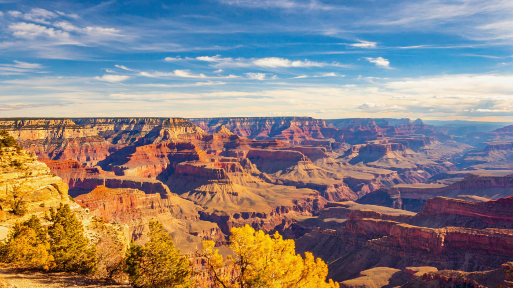
Grand Canyon South Rim Weather Patterns Explained: What Temperature, Wind, and Rim-to-River Gradient Really Mean for Hikers
Most visitors arrive at the South Rim clutching a single number: the forecast temperature. They check the weather app, see 72°F, and pack accordingly. Then they descend 4,000 feet into the canyon and wonder why it’s 98°F at Indian Garden, why the wind is ripping across the Bright Angel Trail at midmorning, and why the river corridor feels like a different planet entirely. Grand Canyon weather is not a single data point, it’s a stacked system of layered microclimates that changes by elevation, season, time of day, and the specific drainage you’re standing in. Understanding that system is the difference between a challenging but rewarding hike and a trip that ends with a ranger rescue.
This guide breaks down exactly how Grand Canyon weather works, what the rim-to-river temperature gradient actually means in practice, how trail conditions shift across seasons, and what every hiker needs to understand before they take a single step below the rim. Whether you’re planning a day hike, a multi-day backpacking trip, or simply trying to figure out the best time to visit the Grand Canyon, the following framework will change how you think about weather planning entirely.
Why Rim Temperature Is a Misleading Starting Point
The South Rim sits at roughly 6,800 feet above sea level. That elevation matters enormously, because it means rim temperatures are consistently 10 to 20°F cooler than the inner canyon on any given day. A 75°F morning on the rim can correspond to a 95°F afternoon at the Colorado River, 4,380 feet below. The standard weather app pulls data from a rim-level station, which tells you almost nothing about conditions on the Bright Angel Trail below the 3-mile resthouse, in the Tonto Platform, or along the River Corridor.
The canyon’s depth creates what meteorologists call an orographic effect: air masses behave differently as they descend and compress, warming at a predictable rate. In the Grand Canyon, that rate works out to roughly 5°F of temperature gain for every 1,000 feet of descent. This is not a rough estimate, it is a consistent physical phenomenon driven by adiabatic warming of descending air. On a day when the South Rim records 80°F, the Phantom Ranch area near the river can simultaneously record 100°F or higher. During summer, when rim temperatures routinely hit the upper 80s and low 90s, the inner canyon becomes genuinely dangerous for unprepared hikers.
The Inversion Effect in Winter and Early Spring
The temperature gradient doesn’t only run hot-below, cool-above. During winter months, temperature inversions can flip the pattern temporarily. Cold, dense air pools in the lower canyon while warmer air sits above, particularly in the weeks following major winter storms. Hikers descending in late December or January sometimes find frost and ice at the rim and trailhead while the inner canyon remains warmer and calmer. This inversion is well-documented at Grand Canyon and occurs because cold air, being denser, sinks into the narrow corridor and becomes trapped.
The practical implication: winter hikers should not assume the canyon floor is as cold as the rim. It’s often more hospitable below the rim in winter than above it, but the trailhead and upper sections can be icy and treacherous. The National Park Service Grand Canyon weather page provides current conditions for both the rim and inner canyon, a resource that should be checked within 24 hours of any hike.
What “Feels Like” Temperature Means in a Desert Canyon
Humidity in the Grand Canyon is typically very low, often below 15% in summer. Low humidity accelerates sweat evaporation so efficiently that hikers frequently underestimate how hard their bodies are working. You won’t feel drenched in sweat even when you’re losing fluid rapidly. The “feels like” temperature on a weather app accounts for humidity, but it doesn’t account for the radiant heat bouncing off canyon walls, the lack of shade on exposed switchbacks, or the physical exertion of climbing 4,000 feet in elevation. Real-world heat stress inside the canyon is consistently higher than any digital forecast suggests.
The National Park Service has documented this disconnect extensively. Their heat-related illness guidance for Grand Canyon notes that hikers routinely misjudge their physical state because the dry air masks the sensation of overheating until it’s already become dangerous. Understanding this is foundational to safe trip planning.
Grand Canyon Weather by Season: A Practical Breakdown
Grand Canyon weather by season follows a pattern that experienced hikers and rangers understand well, but that first-time visitors often misread based on general American travel assumptions. Here’s how each season actually plays out on the South Rim and below it.
Summer (June Through August): Heat Management Is Everything
Summer is the single most popular visitation period at Grand Canyon, and also the most physically demanding for hikers. June is typically the hottest month before the monsoon pattern arrives. Rim temperatures frequently reach the mid-80s to low 90s°F, while inner canyon temperatures at the river level can reach 110°F to 115°F. The rocks absorb heat all day and radiate it back through the night, meaning the canyon floor stays warm well after sunset.
The critical concept for summer hiking is the turnaround rule: the NPS recommends that day hikers below the rim turn around by 10:00 AM during summer months, regardless of how good they feel. The hike out is always harder and hotter than the hike in, and hikers who feel strong at the 3-mile resthouse at 11:00 AM are often in genuine distress on the climb back at 2:00 PM.
The North American Monsoon typically arrives at Grand Canyon between mid-July and mid-August. This seasonal shift brings afternoon thunderstorms that can develop rapidly, with lightning, flash flooding, and brief but intense rainfall. Monsoon storms are localized and fast-moving, which means conditions can go from sunny to severe in under an hour. Flash flood risk in narrow side canyons increases dramatically during this period, and hikers should always have an exit plan and monitor skies from midday onward.
Despite the heat, summer mornings between 4:00 AM and 9:00 AM offer some of the most spectacular hiking conditions of the year. Experienced canyon hikers time their descents to begin before sunrise, enjoy cooler temperatures in the lower canyon during early morning, and complete their ascent before the worst heat of the day.
Fall (September Through November): The Sweet Spot Season
Fall is widely considered the optimal season for Grand Canyon hiking, particularly the months of September through November. Monsoon rains taper off after mid-September, leaving skies clear and air quality excellent. Rim temperatures drop into the 60s and 70s°F, inner canyon temperatures moderate significantly, and the crowds that define summer begin to thin. Trail conditions are typically at their best: dry, stable, and well-maintained after the summer season.
October in particular offers a combination of moderate temperatures, stable weather, and reduced visitor density that makes it the most balanced choice for first-time visitors who want to hike below the rim. The cottonwood trees along Bright Angel Creek turn gold in late October, creating one of the canyon’s most visually striking seasonal moments.
One fall-specific consideration: daylight hours shorten noticeably from September through November. Hikers planning ambitious routes need to account for earlier sunsets, which compress the usable hiking window and make headlamps essential for anyone attempting before-dawn starts or late descents.
Winter (December Through February): Underrated and Undervisited
Winter at the South Rim is dramatically underestimated as a travel season. Rim temperatures average in the 30s to low 40s°F, and snowfall is common, but the canyon itself is often warmer, drier, and strikingly beautiful under winter skies. Visitor numbers drop substantially from summer peaks, meaning popular viewpoints and trailheads are genuinely accessible without the crowds that define summer mornings.
Grand Canyon trail conditions in winter require specific preparation. The upper sections of Bright Angel Trail and South Kaibab Trail can be icy and snow-packed from the rim down to roughly the 3-mile resthouse. Microspikes or traction devices are strongly recommended and sometimes required by rangers for safe passage on these sections. Below the snow line, trails typically clear quickly and the inner canyon remains walkable throughout winter.
Winter light has a quality that photographers prize above all other seasons: low-angle sun, long shadows, and frequent cloud inversions that fill the canyon with fog while the rim stays clear. These inversion events, where clouds settle below the rim level, are among the most photographed weather phenomena in the American Southwest.
For couples, solo travelers, and off-peak visitors looking for a genuinely different Grand Canyon experience, winter travel offers a quieter, more contemplative version of the park. Lodging inside the park and in Tusayan is more available, and the overall pace of the canyon slows considerably.
Spring (March Through May): Variable but Rewarding
Spring is the most weather-variable season at Grand Canyon. March can deliver winter-like conditions with snow and ice at the rim while April begins to warm rapidly. May sits on the edge of summer heat, and late May can already produce dangerous inner-canyon temperatures that rival early June. The variability makes spring planning more complex than other seasons, but the rewards are significant: wildflowers bloom along the rim and in sheltered canyon areas, migrating birds move through, and the Bright Angel Creek runs with snowmelt-fed water.
April is generally the most stable spring month for hiking, with rim temperatures in the 50s to 60s°F and inner canyon temperatures that remain manageable throughout the day. The shoulder season crowd levels are moderate, higher than winter but lower than the summer peak, making trail access easier and campsite availability at Bright Angel Campground more reliable.
The Rim-to-River Temperature Gradient: Reading It Like a Local
The rim-to-river gradient is the most important weather concept for any Grand Canyon hiker to internalize. It’s not just about temperature, it encompasses wind, humidity, shade availability, and the radiant heat load from canyon walls. Understanding how these variables interact across elevation zones transforms how you plan every aspect of a canyon hike.
The Three Elevation Zones and Their Distinct Climates
Experienced canyon hikers think in three elevation zones, each with its own microclimate:
Zone 1: The Rim Layer (6,800 to 6,000 feet). This is where most visitors experience the canyon, and where standard weather forecasts apply. Wind is typically most pronounced here, especially during spring when jet stream patterns bring sustained winds across the Colorado Plateau. Temperatures are coolest, shade is available from pinyon-juniper forest, and the main physical hazard in summer is sunburn rather than heat exhaustion.
Zone 2: The Tonto Platform (3,800 to 4,200 feet). The Tonto Platform is an open, exposed bench of Tapeats Sandstone that stretches across much of the inner canyon. It sits well below the rim’s cooling influence and is almost entirely without shade. Wind behaves differently here, the canyon walls funnel air, creating localized gusts and unpredictable patterns. In summer, the Tonto Platform is genuinely dangerous in the midday hours. In spring and fall, it’s one of the most scenic walking environments in the American Southwest. The temperature difference between Zone 1 and Zone 2 is typically 15 to 25°F.
Zone 3: The River Corridor (2,400 feet). The Colorado River corridor sits in a narrow inner gorge of Vishnu Schist, among the oldest exposed rock on Earth. Temperatures here are highest, wind is minimal due to the canyon walls, and shade is limited to overhanging walls and riparian vegetation along the river. In summer, this zone should be treated with extreme caution by day hikers. Overnight visitors at Phantom Ranch or Bright Angel Campground experience the river corridor at its best: cool mornings, warm evenings, and the sound of the river as a constant backdrop.
Wind Patterns That Don’t Show Up in Any Forecast
Wind is perhaps the most underreported weather variable at Grand Canyon. The South Rim sits on the edge of the Colorado Plateau, a region known for strong seasonal winds, particularly in March and April. Sustained winds of 20 to 35 mph are not unusual on the rim during spring, and gusts can exceed 50 mph during strong frontal passages. On exposed viewpoints and the South Kaibab Trail’s ridgeline sections, wind at this strength creates genuine stability hazards, particularly for children, pets, and anyone carrying a large backpack.
Within the canyon, wind behavior changes completely. The canyon walls act as a venturi, accelerating air through narrow drainages and creating localized gusts that don’t appear in any forecast. Hikers on the Bright Angel Trail often notice a persistent updraft in the afternoons, driven by thermal heating of the canyon walls. On the South Kaibab Trail’s exposed ridge sections, wind can be significantly stronger than at rim-level viewpoints because the trail occupies a narrow spine with exposure on both sides.
The practical implication: always check wind forecasts separately from temperature forecasts, and treat any spring hike on the South Kaibab’s upper sections with additional caution if winds are above 20 mph.
How Trail Conditions Change With Weather: Bright Angel vs. South Kaibab
The two primary corridor trails on the South Rim, Bright Angel Trail and South Kaibab Trail, respond to weather conditions very differently, and choosing between them should always account for current and forecast conditions.
Bright Angel Trail: Weather-Resilient but Sun-Exposed in Sections
Bright Angel Trail descends along a natural fault line in the canyon, following Bright Angel Creek for much of its lower section. This drainage alignment provides two significant weather advantages: intermittent shade from canyon walls during morning and afternoon hours, and reliable water availability at Indian Garden (now renamed Havasupai Garden) and at the 1.5-mile and 3-mile resthouses during the non-winter season. Water availability is a critical safety factor in summer, when dehydration is the primary medical emergency on the trail.
In winter, Bright Angel’s upper two miles are often snow-packed and icy. The trail surface is limestone and packed dirt, which becomes extremely slippery when wet or frozen. Rangers at the trailhead can advise on current conditions, and traction devices are frequently recommended from November through March. Below the 3-mile resthouse, the trail typically clears of ice quickly even after winter storms.
During monsoon season, Bright Angel Creek rises rapidly after upstream storms. The creek crossings on the lower trail can become impassable during peak flow events. If you’re planning a hike to Phantom Ranch or the river during July and August, monitor weather upstream as well as at the rim, a storm 30 miles north can send a flood surge down Bright Angel Creek within hours.
South Kaibab Trail: No Water, No Shade, Maximum Exposure
South Kaibab Trail is a fundamentally different hiking environment. It follows a ridgeline rather than a drainage, meaning it has no water sources between the trailhead and the Colorado River, and it offers almost no shade at any point along its 6.7-mile length. These characteristics make South Kaibab dramatically more weather-sensitive than Bright Angel.
In summer, the NPS advises against descending South Kaibab beyond Cedar Ridge (1.5 miles) as a day hike, and strongly discourages any attempt to hike to the river and back in a single day via this trail regardless of season. In winter, the ridgeline exposure means hikers face both ice risk and wind exposure simultaneously. In spring, the trail offers unmatched panoramic views but requires careful wind assessment before committing to exposed upper sections.
South Kaibab’s weather disadvantages are also its aesthetic strengths. The ridgeline position delivers 360-degree views of the canyon that no other South Rim trail can match. For hikers with appropriate planning, timing the South Kaibab descent for early morning during cooler months produces some of the most dramatic hiking photography available in the American Southwest.
Planning Your Visit Around Weather: A Decision Framework
The following framework helps hikers and visitors systematically assess Grand Canyon weather conditions before committing to any trail plan. Use it as a pre-trip checklist rather than a casual reference.
| Season | Rim Temp Range | Inner Canyon Temp Range | Primary Hazard | Recommended Hike Start Time | Traction Devices Needed? |
|---|---|---|---|---|---|
| June | 80–95°F | 105–115°F | Heat exhaustion, hyponatremia | Pre-dawn (4:00–5:00 AM) | ❌ |
| July–Aug | 75–90°F | 95–110°F | Heat + flash flooding (monsoon) | Pre-dawn (4:00–5:00 AM) | ❌ |
| September | 65–85°F | 85–100°F | Residual heat, early monsoon storms | Sunrise or just before | ❌ |
| October–Nov | 45–70°F | 65–85°F | Shorter daylight, early dark | Sunrise | ⚠️ (Nov only, upper trail) |
| Dec–Feb | 20–45°F | 40–65°F | Ice, snow on upper trails | After sunrise (light needed) | ✅ (strongly recommended) |
| March–April | 35–65°F | 55–80°F | High winds, variable conditions | Sunrise or just after | ⚠️ (March, upper trail) |
| May | 55–80°F | 75–100°F | Rapid heat buildup, dehydration | Pre-dawn (5:00–6:00 AM) | ❌ |
The 50/50 Hydration Rule and Why It Matters
The NPS recommends drinking one liter of water for every hour of hiking in the Grand Canyon, a rate that surprises hikers accustomed to trail conditions elsewhere. The equally important counterpart to this rule is the salt replacement requirement: drinking large volumes of water without replacing electrolytes leads to hyponatremia, a dangerous condition caused by low sodium levels in the blood. Several Grand Canyon rescues each year involve hikers who consumed adequate water but neglected electrolyte replacement.
Salty snacks, electrolyte tablets, or sports drinks should be part of every hiking kit regardless of season. This is especially critical during monsoon months when hikers may not feel thirsty despite significant fluid loss.
What Weather Means for the Grand Canyon Visitor Experience Beyond Hiking
Weather shapes the Grand Canyon experience far beyond the trails. Rim viewpoints, sunrise and sunset timing, photography conditions, and the overall sensory quality of the visit all vary significantly with season and daily weather patterns.
Sunrise and Sunset Viewing by Season
The Grand Canyon’s most photographed moments, sunrise over the eastern canyon, sunset painting the western walls, are weather-dependent in ways that aren’t obvious from a distance. Clear skies produce beautiful but sometimes flat light; partly cloudy days produce dramatic, dynamic color. The post-monsoon atmosphere in September and October is particularly rich with dust particles and moisture that scatter light and create the saturated orange-and-red hues that appear in the most iconic Grand Canyon images.
Mather Point and Yavapai Point are the most accessible sunrise viewpoints on the South Rim. Hopi Point and Mohave Point offer the most expansive sunset views. During peak summer season, reaching these viewpoints at sunrise requires arriving 30 to 45 minutes before first light to secure a position, as crowds gather well before dawn. In winter, sunrise viewpoints are often nearly empty, allowing for an unobstructed, personal experience that summer visitors rarely access.
Cloud Inversions and Fog Events
One of the most visually spectacular weather phenomena at Grand Canyon occurs during temperature inversions, typically in winter, when a sea of clouds fills the canyon while the rim stays clear and sunny. This event, sometimes called a “cloud inversion” or “fog filling,” happens when cold, moist air is trapped below the rim level and forms a cloud layer that mimics a foggy sea. From the rim, visitors look out over what appears to be a white cloud ocean, with only the highest buttes and temples of the canyon emerging above the surface.
These events are impossible to predict more than 24 to 48 hours in advance, and they typically last only a few hours before warming dissipates the cloud layer. Visitors who happen to be at the rim during one of these events consistently describe it as the most memorable moment of their visit.
Photography Conditions by Season
For photographers and nature enthusiasts, the light quality at Grand Canyon varies dramatically by season. Winter provides the lowest sun angle, which means longer shadows, more dimensional texture in the canyon walls, and golden-hour light that lasts longer relative to summer. Summer’s high sun angle at midday creates flat, harsh light that washes out the canyon’s subtle color variation. The hour after sunrise and the hour before sunset are productive shooting windows in any season, but summer’s early sunrise and late sunset compress the midday dead zone significantly.
Monsoon storm light is a separate category entirely. The combination of dark storm clouds, sunlit canyon walls, and visible rain curtains in the distance produces images that are impossible to achieve in any other season. Photographers who specifically time visits to the early monsoon period (mid-July through August) often produce their most dramatic work, though they must be prepared for rapidly changing conditions and have solid understanding of lightning safety.
Grand Canyon Travel Tips: Weather Preparation That Actually Matters
Beyond the foundational temperature and trail knowledge, experienced Grand Canyon visitors develop a set of practical habits that make weather variables manageable rather than dangerous. These Grand Canyon travel tips are drawn from the kinds of preparation patterns that separate smooth visits from difficult ones.
Layer Strategically, Not Just Heavily
The rim-to-river temperature swing of 20 to 30°F means layering is essential in every season except peak summer. The challenge is that many hikers either over-layer (arriving at the river sweating through heavy cotton) or under-layer (reaching the rim in the afternoon in a single moisture-soaked shirt). The optimal approach is three moisture-wicking layers: a lightweight base layer, an insulating mid-layer that can be removed and stowed easily, and a wind/rain shell for rim conditions. This system works in every season and allows precise temperature management as elevation changes.
Cotton is the most common clothing mistake at Grand Canyon. Cotton retains moisture and loses its insulating value when wet. In winter, a wet cotton layer can accelerate hypothermia risk on the windy rim. In summer, sweat-soaked cotton creates chafing on long descents. Synthetic or merino wool fabrics for all layers in contact with skin are a consistent recommendation from experienced canyon hikers.
The Two-Source Weather Check
Responsible canyon trip planning requires checking at least two weather sources: the standard forecast for the South Rim (available through the National Weather Service Grand Canyon forecast) and the inner canyon forecast, which the NPS provides separately and which can differ dramatically from rim-level conditions. Checking only a single weather app the morning of a hike is not adequate preparation for an inner canyon descent.
Acclimatization for Altitude-Sensitive Visitors
At 6,800 feet, the South Rim sits at an elevation that affects visitors arriving from sea level or near-sea-level cities. Reduced oxygen availability at this altitude means cardiovascular effort increases for any given physical activity, and the effects of heat stress are amplified. First-time visitors arriving from cities at or near sea level should allow at least one full day at rim elevation before attempting any significant below-rim hiking. Altitude-related fatigue is commonly mistaken for simple tiredness, and visitors who push through it into a strenuous canyon descent compound their risk significantly.
Footwear and the Ice Factor
Footwear is a weather-dependent decision at Grand Canyon. Trail runners or lightweight hiking shoes are adequate for most warm-season hiking on the corridor trails. In winter, the upper sections of both Bright Angel and South Kaibab require boots with ankle support and the ability to accommodate microspike traction devices. Flip-flops and casual sneakers, among the most common footwear choices observed at canyon trailheads, are appropriate for rim walking but genuinely dangerous on icy trail sections.
The Tusayan shuttle service is a practical tool for visitors planning to access multiple trailheads and viewpoints on the same day, particularly when road conditions in winter make driving to outlying viewpoints inconvenient or risky.
Starting Your Visit Right: Grand Canyon Visitor Center IMAX as a Weather-Oriented Orientation Stop
One underappreciated aspect of the Grand Canyon South Rim visitor center question is where to begin your visit before you even reach the park gates. Located in Tusayan just outside the South Rim entrance, Grand Canyon Visitor Center IMAX serves as a practical orientation hub that helps visitors understand what they’re about to enter, including the canyon’s scale, geology, and the environmental conditions that define the experience.
The flagship film, “Grand Canyon: Rivers of Time,” screens on a six-story IMAX screen using IMAX with Laser technology and delivers an immersive cinematic overview of the canyon’s geological history and physical grandeur. For first-time visitors arriving without a clear understanding of the canyon’s scale, the film provides crucial context that transforms what they’ll see at the rim from “a very large hole” into a comprehensible geological narrative. Seeing the canyon’s depth, the river’s force, and the layered rock sequence on a six-story screen before standing at the rim changes how visitors perceive and engage with what they’re looking at. You can book IMAX tickets online in advance and save 20%.
Beyond the theater, Grand Canyon Visitor Center IMAX offers practical services that directly support weather-smart trip planning. The on-site retail store stocks hiking gear, including the kinds of items that weather-underprepared visitors urgently need: sun protection, electrolyte products, trekking poles, and layers. National Park entrance passes are available for purchase on-site, which matters significantly during peak season when entry lines can add time to an already-compressed hiking morning. Pink Jeep Tours, recognized as the Best Tour Operator, departs directly from the front door, and every Pink Jeep Tour originating from Grand Canyon Visitor Center IMAX includes a “Rivers of Time” IMAX ticket.
For EV drivers and road-trippers, the facility offers Ultra-Fast 150 kW and Hyper-Fast 350 kW charging stations, making it a logical stop whether you’re arriving or departing. And unlike the official NPS Visitor Center inside Grand Canyon Village, Grand Canyon Visitor Center IMAX is located before the entrance gates, meaning you can access all of these services without first paying park admission.
Thinking about the weather you’ll face inside the canyon and having the right gear, orientation, and logistics sorted before you enter the park is exactly the kind of planning that makes the difference between a prepared visit and a reactive one. The stop in Tusayan is where that preparation happens most efficiently.
Frequently Asked Questions About Grand Canyon Weather and Trail Conditions
What temperature should I expect at the bottom of the Grand Canyon?
The inner canyon near the Colorado River runs approximately 20 to 30°F warmer than the South Rim on any given day. During summer months, river-level temperatures regularly exceed 100°F, and during the hottest June days can approach 115°F. Even in winter, the river corridor often stays in the 50s and 60s°F when the rim is below freezing.
Is it safe to hike the Grand Canyon in summer?
Hiking below the rim in summer is possible but requires strict preparation and timing. The NPS recommends beginning all below-rim hikes before sunrise during summer months, turning around by 10:00 AM, carrying at least one liter of water per hour of hiking, and including salty snacks for electrolyte replacement. Day hikes to the river and back in a single summer day are strongly discouraged by the National Park Service for all but the most experienced canyon hikers.
What is the best time of year to hike the Grand Canyon?
October and April are widely considered the most balanced months for below-rim hiking. Both offer moderate temperatures at rim and inner canyon levels, stable weather patterns, and good trail conditions. October has the added advantage of post-monsoon clear skies and autumn color along Bright Angel Creek. For first-time hikers, October is the most forgiving month across all variables.
Does it snow at the Grand Canyon?
Yes. The South Rim receives regular snowfall from November through March, with the heaviest accumulation typically occurring in January and February. Snow transforms the canyon’s visual character dramatically and creates some of its most photographed conditions. However, snow and ice on the upper trail sections require traction devices and change the difficulty rating of corridor trails significantly.
What are monsoon conditions like at Grand Canyon?
The North American Monsoon brings afternoon and evening thunderstorms to Grand Canyon from mid-July through mid-September. Storms develop rapidly, often within one to two hours, and bring lightning, heavy rain, and flash flood risk in canyon drainages. Hikers should monitor skies from noon onward during this period and have a clear plan for retreating to higher ground or shelter if storms develop.
Is the Bright Angel Trail or South Kaibab Trail better in hot weather?
Bright Angel Trail is significantly safer in hot weather because it has water available at the 1.5-mile resthouse, 3-mile resthouse, and Havasupai Garden (seasonal), and it offers more shade from canyon walls. South Kaibab has no water and almost no shade, making it substantially more dangerous for extended summer hiking. For summer day hikes, Bright Angel is strongly preferred.
How windy does the Grand Canyon get?
Wind is most significant at the South Rim during spring (March through May), when sustained winds of 20 to 35 mph are common and gusts can exceed 50 mph during frontal passages. The South Kaibab Trail’s ridgeline is especially exposed to wind. Within the canyon, wind is less consistent but can be funneled and accelerated through narrow drainages. Always check wind forecasts separately from temperature forecasts before committing to exposed trail sections.
What should I wear for a Grand Canyon hike in winter?
Winter hiking at Grand Canyon requires moisture-wicking base layers, an insulating mid-layer, and a wind/waterproof shell. Boots with ankle support are recommended over trail runners for the upper trail sections, and microspike or other traction devices are essential when ice is present. Avoid cotton in any layer. Gloves, a warm hat, and a neck gaiter are practical additions for rim-level walks and upper-trail descents.
Can I see the Grand Canyon in the rain?
Yes, and rainy conditions produce some of the canyon’s most dramatic visual experiences. Waterfalls appear on canyon walls that are dry for most of the year, the rock colors deepen and saturate, and the light quality during and after storms is extraordinary. The primary concern during rain is slippery trail surfaces on the upper sections and flash flood risk in low-lying drainages. Rim viewpoints are fully accessible in light rain with appropriate rain gear.
How far in advance should I check the weather before visiting Grand Canyon?
Check forecasts 72 hours out for general planning purposes, then recheck within 24 hours of your visit for current conditions. For below-rim hiking, always check the NPS inner canyon forecast, not just a standard weather app that reflects rim-level conditions. The National Park Service updates trail condition reports regularly on the official Grand Canyon planning page.
Does Grand Canyon Visitor Center IMAX operate year-round?
Yes. Grand Canyon Visitor Center IMAX in Tusayan operates year-round, making it accessible in every season including winter months when some in-park services operate on reduced schedules. The facility’s location just outside the South Rim entrance gates means it remains available regardless of in-park road or service conditions.
What is a temperature inversion at Grand Canyon?
A temperature inversion occurs when the normal temperature gradient is reversed: cold, dense air pools in the lower canyon while warmer air sits above. This happens most often in winter and can produce the spectacular “cloud inversion” phenomenon where fog or clouds fill the canyon below the rim while the rim itself remains clear and sunny. These events are unpredictable more than 24 to 48 hours in advance and typically last only a few hours.
Key Takeaways for Grand Canyon Weather and Trail Planning
- Rim temperature is not inner canyon temperature. Expect 20 to 30°F warmer conditions at the river than at the South Rim on any given day. Plan your hike, gear, and water supply for the bottom of the canyon, not the top.
- Grand Canyon weather by season follows predictable patterns, summer heat and monsoon storms, fall calm and ideal hiking, winter ice and spectacular inversions, spring wind and variable conditions, but daily variation within each season requires checking current NPS forecasts.
- Water and electrolytes are non-negotiable. One liter per hour of hiking, with consistent electrolyte replacement, is the NPS-recommended baseline for any below-rim hike in any season.
- Trail choice matters as much as timing. Bright Angel Trail has water and shade; South Kaibab has neither. In summer and on hot days in any season, Bright Angel is the safer choice for day hikes.
- The best time to visit the Grand Canyon for most hikers and first-time visitors is October, followed closely by April. Both months offer stable weather, moderate temperatures, and manageable crowds.
- Winter is underrated. The South Rim in December and January offers dramatically reduced crowds, unique visual conditions, and accessible below-rim hiking for prepared visitors.
- Start your visit in Tusayan. Grand Canyon Visitor Center IMAX provides essential orientation, practical gear and pass purchasing, and the “Grand Canyon: Rivers of Time” IMAX experience that gives visitors genuine context for what they’re about to see. Book online in advance to save on IMAX tickets.
- Always check two weather sources: the rim forecast and the NPS inner canyon forecast. They can differ by 30°F and they describe completely different physical environments.
Weather at the Grand Canyon is not an obstacle to navigate, it’s part of what makes the place extraordinary. The same physical forces that create the canyon’s temperature gradients, wind patterns, and seasonal transformations are the forces that carved it. Visitors who understand the weather understand the canyon itself at a deeper level, and that understanding transforms every hour spent at the rim or below it into something more than just sightseeing. It becomes an encounter with a genuinely dynamic, living landscape, one that rewards preparation with some of the most memorable experiences available anywhere in the American Southwest.

About the author
Explore The Canyon Editorial Team
See The Canyon
Learn more →

