

How to Read Grand Canyon Trail Conditions and Closures Before Your Hike
Picture this: you’ve driven seven hours, packed your daypack the night before, and woken up at 5 a.m. to catch sunrise on the rim. You pull into the South Rim parking area, lace up your boots, and walk to the trailhead, only to find an orange closure sign and a ranger explaining that the trail has been sealed off for emergency rock stabilization work. No warning. No backup plan. The morning is blown.
This scenario plays out more often than most visitors realize. The Grand Canyon is not a static landscape. It shifts, erodes, floods, catches fire, and freezes. Grand Canyon trail closures and condition changes can happen with very little public fanfare, and the hikers who get caught off guard are almost always the ones who assumed conditions online matched conditions on the ground. This guide is built specifically to fix that gap, walking you through every reliable source, every real-time check, and every decision point you should work through before you ever leave your car.
Whether you’re a first-timer planning months in advance or a spontaneous traveler arriving tomorrow morning, reading trail conditions correctly is the single highest-leverage skill you can develop before entering the canyon. Here’s how to do it right.
What You Need Before You Start Checking Conditions
Before you can interpret Grand Canyon trail conditions accurately, you need to know which trails, which rims, and which zones you’re actually planning to visit. The Grand Canyon is enormous, spanning 277 river miles and covering over a million acres, and conditions vary dramatically between the South Rim, North Rim, inner canyon corridors, and backcountry zones. A trail open at the rim may connect to a corridor that’s closed two miles down.
The most common mistake hikers make when checking conditions is treating the park as a single unit. They search “Grand Canyon trail conditions,” skim the first result, see no red flags, and assume they’re good to go. In reality, the park’s trail network is segmented into distinct zones that are managed, monitored, and updated separately. Understanding this structure upfront makes every subsequent step in this guide faster and more accurate.
Tools and Resources to Have Ready
Before you begin your pre-hike condition check, gather the following:
- A specific trail name or corridor name (e.g., Bright Angel Trail, South Kaibab Trail, Hermit Trail, North Kaibab Trail)
- Your planned hike date and start time, conditions are reported differently for same-day hikes versus future planning
- A smartphone or tablet with cellular data or downloaded offline maps (cell coverage inside the canyon is limited to non-existent)
- The NPS Grand Canyon official website URL bookmarked: the Grand Canyon’s documented trail system is extensive, and having reference material loaded before you lose signal is critical
- A note-taking method to record current conditions, water source status, and any posted warnings
Estimated time for a full condition check: 20–45 minutes. Rushing this process is where hikers get into trouble. Build it into your trip planning as a non-negotiable step, not an afterthought.
Know Your Hike Category
The National Park Service classifies Grand Canyon hikes into four broad categories, and the type of check you need varies by category:
| Hike Type | Trail Examples | Condition Check Depth | Lead Time Needed |
|---|---|---|---|
| Rim Walk (paved) | Rim Trail, Mather Point area | Basic, road/path closures only | Same day check OK |
| Day Hike (corridor) | Bright Angel, South Kaibab | Moderate, weather, water, heat alerts | 48–72 hours out |
| Overnight Corridor Hike | Phantom Ranch route, Ribbon Falls | Deep, campsite status, water sources, ranger alerts | 1–2 weeks out, recheck 48 hrs |
| Backcountry / Wilderness | Hermit Trail, Grandview, Thunder River | Comprehensive, all sources, permit status | 2–4 weeks out, recheck weekly |
Step 1: Start With the Official NPS Alerts Page (Not the Homepage)
The single most reliable source for Grand Canyon trail closures and current park conditions is the National Park Service’s official alerts and conditions page, not the park’s homepage. This is a critical distinction. The NPS homepage for Grand Canyon is designed for general visitors and trip inspiration, it won’t surface a trail closure that was posted yesterday. The alerts and conditions section is a live, regularly updated database of active notices.
Many hikers skip directly to trail description pages or trip planning tools and miss active closure notices entirely. The alerts page is where rangers post emergency closures, construction-related path restrictions, fire zone boundaries, and flood warnings. It is updated by park staff and reflects ground-level reality far more accurately than any third-party hiking app or travel blog (including this one).
How to Navigate the NPS Alerts Page Correctly
Follow these exact steps:
- Open a browser and navigate to nps.gov/grca. This is the official Grand Canyon National Park homepage.
- Look for the “Alerts and Conditions” tab or banner. On the NPS site, this appears as a colored banner at the top of the page when active alerts exist. Click it.
- On the alerts page, you will see notices categorized by type: Closures, Cautions, Information, and Danger. Pay closest attention to Closures and Danger notices first.
- Each alert will list a title, affected area or trail, the date it was posted, and a description. Read the full description, do not skim titles only. A closure titled “Trail Rehabilitation Work” may affect only a 200-yard segment, or it may close the entire corridor.
- Note the “Last Updated” date on each alert. If an alert hasn’t been updated in several weeks during a high-activity season, call the park directly to confirm it’s still active.
- Screenshot or write down every active alert that affects your planned route.
Common mistake to avoid: Assuming that no banner on the homepage means no active closures. Alerts are only surfaced as homepage banners for major, high-impact events. Minor trail segment closures, maintenance work, and seasonal water shutoffs may be buried in the alerts database without triggering a homepage banner.
Pro Tip: Use the NPS App for Offline Access
The official NPS app allows you to download park maps and some condition information for offline use. This is especially valuable for Grand Canyon visitors because cell coverage disappears quickly once you descend below the rim. Download the Grand Canyon map layer before you leave your lodging, and note any active alerts in a separate note on your phone. Do not rely on being able to load the NPS website from inside the canyon.
Step 2: Check Weather Conditions From Multiple Sources, Not Just One
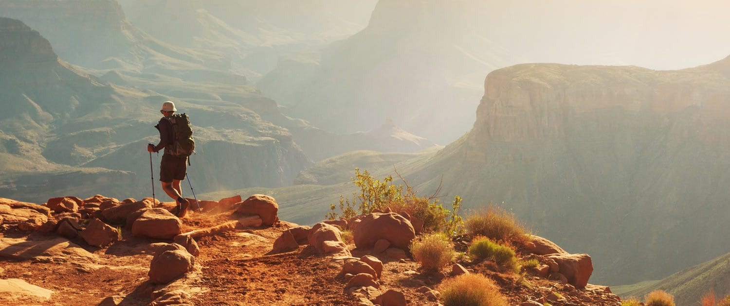
Weather at the Grand Canyon is one of the most misunderstood hazards in American hiking, and a single weather app check is not sufficient for safe trip planning. The canyon creates its own microclimate, and temperatures at the rim can be 20°F cooler than temperatures at the Colorado River. A calm, clear morning at the South Rim can become a dangerous heat event on the inner canyon trails by mid-afternoon. Thunderstorms that appear to be miles away at the rim can trigger flash floods in canyon corridors with no warning whatsoever.
Weather is also the leading trigger for temporary trail conditions changes that don’t always show up in official NPS alerts. A heavy overnight rain can turn a packed dirt trail into a mudslide zone. Ice accumulation after a winter storm can make paved rim paths dangerous without any formal closure being issued.
The Multi-Source Weather Check Protocol
Use all three of the following sources and compare them before finalizing your hiking plan:
- National Weather Service (weather.gov): Search for “Grand Canyon” or enter the zip code for Tusayan (86023 for South Rim area). The NWS provides zone forecasts that cover both the rim elevation (approximately 7,000 feet) and the inner canyon (approximately 2,400 feet at Phantom Ranch). These are separate forecasts and must both be checked.
- NPS Backcountry Information Center conditions line: Call (928) 638-7875. Rangers update recorded condition reports regularly and can provide current water source status, recent trail observations, and any weather-related closures that haven’t yet been posted online.
- Flash flood watch monitoring: The National Weather Service issues flash flood watches that can affect the Grand Canyon even when skies are clear at your trailhead. Search the NWS website for “Grand Canyon flash flood” to find the most current watch/warning status for Coconino County.
Warning: Never hike into a side canyon, drainage, or narrow corridor if there is a flash flood watch active anywhere upstream. The Colorado River drainage covers a vast area, and storms dozens of miles away can send walls of water through canyon slots with zero local warning. This is not a theoretical risk, it is an active, documented cause of fatalities in the canyon.
Seasonal Weather Patterns That Affect Trail Conditions
Understanding the seasonal rhythm of Grand Canyon weather makes condition checks faster and more intuitive:
- Summer (June–August): Inner canyon temperatures routinely exceed 110°F. Heat-related illness is the most common cause of emergency rescues. The park issues “Code Red” heat advisories that restrict hiking below the rim during midday hours. Always check for active heat advisories before a summer hike.
- Monsoon season (July–September): Afternoon thunderstorms are nearly daily events. Flash flood risk is highest during this window. Morning starts are essential, and side trail conditions can change rapidly.
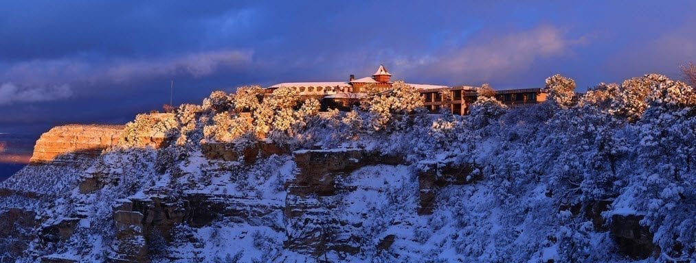
- Winter (November–March): Ice and snow accumulate on rim trails and upper canyon sections. The North Rim closes entirely (typically from mid-November through mid-May). The South Rim remains open year-round but trail surfaces can be hazardous.
- Spring (March–May): Snowmelt increases Colorado River flow and can affect river-adjacent trails. Conditions are generally improving but can remain icy at elevation through April.
Step 3: Look Up Road and Shuttle Access Conditions Before Leaving Your Vehicle
Grand Canyon road closures and shuttle service disruptions directly affect which trailheads you can physically reach, making road condition checks as important as trail condition checks. Several of the most popular trailheads along the South Rim are accessible only via shuttle bus or through roads that close seasonally or due to construction. If you arrive without checking, you may find your target trailhead unreachable.
The South Rim operates a free shuttle bus system with multiple routes, and individual routes are suspended periodically for maintenance, weather, or special events. The Hermit’s Rest Route, for example, is a primary access path to the Hermit Trailhead and several western viewpoints, if this route is suspended, hikers who planned to start at Hermit’s Rest have no easy alternative without their own vehicle and an active parking permit.
How to Check Road and Shuttle Conditions
- Visit the NPS Grand Canyon “Roads and Parking” section at nps.gov/grca. This page lists current road closures, construction projects affecting visitor access, and shuttle route status.
- Check the Arizona Department of Transportation road conditions tool at az511.com for highway conditions on SR-64, the primary access road from Williams and Tusayan into the park. Winter storms can close or restrict this highway with short notice.
- If you’re arriving through the East Entrance on Desert View Drive, note that this road has its own seasonal closure schedule and condition updates separate from the main South Rim Village area.
- For visitors using the Tusayan shuttle service to the South Rim, check current shuttle operating status before departure, seasonal schedules vary and the service is occasionally suspended for special events or operational issues.
Pro tip: Download the Grand Canyon offline map from the NPS app before entering the park, and screenshot the current shuttle route map from the NPS website. Shuttle schedules and route maps are available as PDFs on the NPS site, download the current season’s version before you lose cell service in Tusayan.
Parking and Entry Road Considerations
The South Rim entrance station on SR-64 is the most congested entry point during peak season, and entry road backups can extend well past Tusayan. This doesn’t affect trail conditions directly, but it can significantly impact your start time, which matters enormously if you’re planning to beat summer heat or catch specific light conditions. Entry delays of 45–90 minutes are common during peak summer weekends. Factor this into your departure time from Tusayan.
Step 4: Contact the Backcountry Information Center for Ground-Truth Conditions
No digital source, not the NPS website, not any app, not any blog, replaces a direct conversation with a Grand Canyon ranger about current trail conditions. The Backcountry Information Center (BIC) is staffed by rangers who walk these trails, respond to incidents on them, and receive direct reports from hikers and maintenance crews. Their information is current to within hours, not days.
This step is especially critical for anyone planning an overnight or multi-day hike, anyone planning a hike during or immediately after a weather event, and anyone heading into non-corridor backcountry areas where digital condition reports are sparse. For a casual rim walk or short day hike on the corridor trails, a BIC call is optional but always a smart idea.
What to Ask the Backcountry Information Center
When you call (928) 638-7875, have your trail name, planned date, and overnight destinations ready. Ask specifically:
- “Are there any active closures or restrictions on [your specific trail]?”
- “What are current water source conditions?” (This is critical, water availability changes seasonally and after maintenance work, and dehydration is the leading cause of medical emergencies in the canyon)
- “Have there been any recent rockfall events, trail damage, or hazardous conditions reported on this route?”
- “Is there anything I should know about the next 72 hours of weather that would affect this trail?”
- “Are there any permit or reservation changes I should be aware of?”
The BIC is open daily and rangers are generally very willing to provide detailed, practical information. This call typically takes 5–10 minutes and can prevent a dangerous or wasted trip. It is, without question, the most underused resource available to Grand Canyon hikers.
Alternative: Stop at the Visitor Center on Arrival
If you’re already in the park, the Grand Canyon Visitor Center near Mather Point is staffed with rangers who can provide current condition briefings in person. Trail condition boards are updated regularly and display current water source status, recent closures, and weather advisories. Before you drive to a trailhead, stop at the visitor center, it takes 10 minutes and can save your entire day.
For visitors arriving through Tusayan before entering the park, the Grand Canyon Visitor Center and IMAX facility on Highway 64 serves as an excellent first stop for orientation and current condition information. Staff at the center are familiar with current park conditions and can help visitors understand what they’re walking into before they reach the entrance gate.
Step 5: Interpret What You Find, A Decision Framework for Trail Conditions
Knowing where to find condition information is only half the skill, knowing how to interpret it and make a go/no-go decision is where most hikers struggle. A “caution” notice doesn’t mean the same thing as a “closure.” Icy conditions on the rim don’t necessarily mean the inner canyon is inaccessible. This step gives you a structured decision framework to work through whatever conditions you find.
The framework below is designed around a tiered risk assessment. Work through it in order for every hike, starting with the highest-consequence factors and moving to lower-consequence adjustments.
The Grand Canyon Condition Decision Framework
- Hard Stop Check (Non-Negotiable): Is there an active formal closure on any part of your planned route? If yes, do not proceed on the closed segment. Period. Formal closures carry legal weight and are issued for genuine safety reasons. Violating a closure in the Grand Canyon can result in fines and, more importantly, can put both you and rescue personnel at risk.
- Flash Flood Assessment: Is there an active flash flood watch or warning for Coconino County or any part of the canyon drainage? If yes, do not hike into any narrow canyon, side drainage, or slot canyon area. If you’re on an open corridor trail and the watch is for a distant area, proceed with heightened awareness and a firm turnaround time before afternoon.
- Heat Advisory Check: Is the park operating under a Code Red heat advisory? If yes, the NPS strongly advises against hiking below the rim between 10 a.m. and 4 p.m. Adjust your start time to pre-dawn, reduce your planned depth of descent, and ensure you have more water than you think you need (minimum one liter per hour of hiking in heat).
- Water Source Verification: Are all water sources on your planned route currently operating? The Bright Angel Trail has rest house water stations that are sometimes shut off during winter months. The South Kaibab Trail has NO water sources at all, ever. Confirm your water strategy before you descend, not at the first dry spigot.
- Surface Condition Assessment: Are there reports of ice, mud, rockfall debris, or trail damage on your route? These don’t necessarily mean you can’t hike, but they require equipment adjustments (microspikes for ice, trekking poles for mud), speed reductions, and heightened awareness of overhead hazards in rockfall zones.
- Access Confirmation: Is the trailhead you’re planning to use accessible via your planned method of transportation? Confirm shuttle route status and parking availability.
Condition Severity Quick-Reference Matrix
| Condition Found | Severity | Recommended Action | Flexible? |
|---|---|---|---|
| Formal trail closure, full route | 🔴 Critical | Choose alternate trail entirely | ❌ No |
| Formal closure, segment only | 🔴 Critical | Hike to closure point, turn back | ❌ No |
| Active flash flood watch | 🔴 Critical | Avoid all canyon drainages | ❌ No |
| Code Red heat advisory | 🟠 High | Pre-dawn start, reduce depth | ⚠️ Experienced hikers only |
| Water source offline | 🟠 High | Carry full water supply, adjust route | ⚠️ With proper preparation |
| Ice on upper trail sections | 🟡 Moderate | Bring microspikes, reduce pace | ✅ With gear |
| Muddy trail surface | 🟡 Moderate | Use trekking poles, expect slower pace | ✅ With gear |
| Shuttle route suspended | 🟡 Moderate | Choose accessible trailhead instead | ✅ With alternate plan |
| Caution notice (general advisory) | 🟢 Low | Proceed with awareness of noted hazard | ✅ Fully flexible |
Step 6: Cross-Check With Recent Trip Reports From Real Hikers
Official sources tell you what the park knows, recent hiker trip reports tell you what the trail actually looks, feels, and behaves like right now. These two sources are complementary, not interchangeable. Official NPS alerts are authoritative and legally binding, but they can lag behind rapidly changing ground conditions by hours or even days. A hiker who completed your planned route yesterday can tell you things no ranger has had time to document yet.
Trip reports are particularly valuable for catching conditions that fall below the threshold of an official alert: a water pipe at a rest house that’s technically “on” but barely flowing, a section of trail that’s muddy and requires careful footwork, a rockfall debris field that hasn’t been cleared yet, or a section of trail that’s been informally flagged by maintenance crews without a formal closure being posted.
Best Sources for Grand Canyon Trip Reports
- AllTrails: The most widely used hiking platform in the United States. Filter reviews by “Most Recent” and look for reports dated within the last 7–14 days. Read the actual text of reviews, don’t just look at star ratings. A trail can have a 4.8-star average but a very recent review describing hazardous conditions.
- Grand Canyon Association and NPS Ranger Blogs: The NPS Grand Canyon Facebook page and Instagram account are updated regularly with condition photos and brief reports. These are often faster than the formal alerts database for documenting recent events like rockfall or storm damage.
- Reddit’s r/hiking and r/grandcanyon communities: These forums have active contributors who frequently post trip reports with photos. Search your specific trail name and filter by date. The quality of information varies, but recent reports from experienced hikers can be genuinely useful.
- Hiking and outdoor forums like HikingProject.com: Similar to AllTrails, these platforms aggregate user-submitted condition reports. Less traffic than AllTrails for popular trails, but occasionally more detailed for backcountry routes.
How to evaluate trip report credibility: Look for reports that include specific observations (water source running at the 1.5-mile rest house, ice from the trailhead to about 0.3 miles down, trail surface dry below the Tonto Platform) rather than vague impressions. Reports that describe specific mile markers, water conditions, and surface types are far more useful than “beautiful hike, very hot.”
When Trip Reports Conflict With Official Sources
If a trip report describes a serious hazard that isn’t reflected in official NPS alerts, do two things: call the BIC to report what you’ve read and ask for confirmation, and treat the hazard as real until confirmed otherwise. Rangers appreciate these calls, they often learn about developing conditions through hiker reports before their own crews can verify them. Never dismiss a first-hand account from a recent hiker in favor of an official page that was last updated a week ago.
Step 7: Build Your Contingency Plan Before You Hike
The most experienced Grand Canyon hikers don’t just check conditions, they plan for two or three alternative scenarios based on what they might find. Having a contingency plan isn’t pessimistic; it’s what separates visitors who have great hikes from visitors who waste entire days or worse, push into dangerous conditions because they “came all this way” and don’t want to change their plans.
The “we came all this way” mindset is one of the most documented psychological contributors to hiking accidents in national parks. Sunk cost thinking leads people to proceed despite warning signs they would never ignore if the trip were only an hour away. Grand Canyon trail conditions can deteriorate rapidly, and a plan B is not a fallback, it’s a smart strategic tool.
How to Build an Effective Contingency Plan
- Identify two alternate trails for every primary trail you plan to hike. If Bright Angel is closed or severely congested, your alternates might be the Rim Trail (easy, accessible, no descent) and a guided jeep tour that accesses viewpoints you couldn’t otherwise reach. If South Kaibab is closed, your alternate might be Bright Angel to the 1.5-mile rest house and back.
- Pre-check conditions on your alternates as well. Don’t leave alternate trails unchecked, if your primary hike is shut down, you need to know your alternates are viable before you arrive.
- Establish a hard turnaround time before you leave the trailhead. This time should be based on the maximum temperature forecast for the inner canyon, not on how far you want to go. If it’s summer and the inner canyon will hit 105°F by noon, your turnaround time might be 9 a.m. regardless of how far you’ve gone. Write this time on your arm if necessary.
- Brief your entire group on the contingency plan. Group dynamics often make plan pivots difficult when one member is committed to the original plan. If everyone knows the alternates before you start, pivoting feels like execution rather than failure.
Guided Tours as a Built-In Contingency
One underappreciated advantage of booking a guided tour, whether a Pink Jeep Tour, a mule trip, or a ranger-led hike, is that the guide handles condition monitoring for you. Professional guides have daily contact with park rangers, know current trail and road conditions, and adjust their routes in real time based on what they encounter. For visitors who are unfamiliar with the canyon or uncomfortable interpreting condition reports on their own, a guided experience removes the condition-monitoring burden entirely while ensuring you still see the canyon at its best.
The dramatic vistas and geological wonders that draw millions of visitors to the South Rim each year are accessible through multiple routes and approaches, the goal is to see the canyon safely, not to complete a specific trail. Sometimes the most rewarding Grand Canyon experience comes from an approach you didn’t originally plan.

How Wildfire and Smoke Conditions Affect Grand Canyon Hiking
Wildfire is an increasingly important factor in Grand Canyon trail conditions, and it requires a separate monitoring process from standard trail checks. The canyon and its surrounding forests experience active fire management throughout the year, including both controlled burns and wildfire suppression operations. Fires in the area can affect air quality across the entire South Rim, trigger trail closures in specific zones, and restrict road access via SR-64 or Desert View Drive.
The impacts of fire on a Grand Canyon visit vary widely depending on fire location, wind direction, and whether a controlled burn or an active wildfire is involved. A controlled burn several miles from the rim may produce visible smoke without any trail closures. An active wildfire closer to the park boundary may trigger road closures and evacuations with very short notice.
How to Monitor Fire Conditions
- InciWeb (inciweb.nwcg.gov): The official incident information system for wildfires in the United States. Search for active fires in Arizona or specifically near Grand Canyon. InciWeb provides fire perimeter maps, evacuation orders, road closure information, and regular incident updates.
- NPS Grand Canyon alerts page: The park posts fire-related alerts here, including any trail or road closures resulting from fire activity. This is your first stop for understanding how a nearby fire specifically affects park operations.
- AirNow (airnow.gov): Wildfire smoke can create hazardous air quality even when no closures are in effect. Check the Air Quality Index for the Grand Canyon area, particularly during summer fire season. Strenuous hiking in poor air quality creates serious respiratory risks, especially for children, the elderly, and anyone with asthma or heart conditions.
Visitors who want to understand the role of controlled burns in maintaining the canyon’s ecosystem will find the topic fascinating, the park’s approach to fire management is an active part of its ecological stewardship, as discussed in coverage of South Rim highway reopenings following controlled fire operations. Fire management at the Grand Canyon is not just a safety issue; it’s a conservation tool with a long and nuanced history.
Checking Conditions for Specialized Grand Canyon Activities
Different Grand Canyon activities require different condition checks, and standard trail condition monitoring doesn’t cover everything. If you’re planning whitewater rafting, photography-focused rim hiking, or an adventure experience involving heights or exposure, you need activity-specific condition information on top of your standard trail checks.
River and Water Activity Conditions
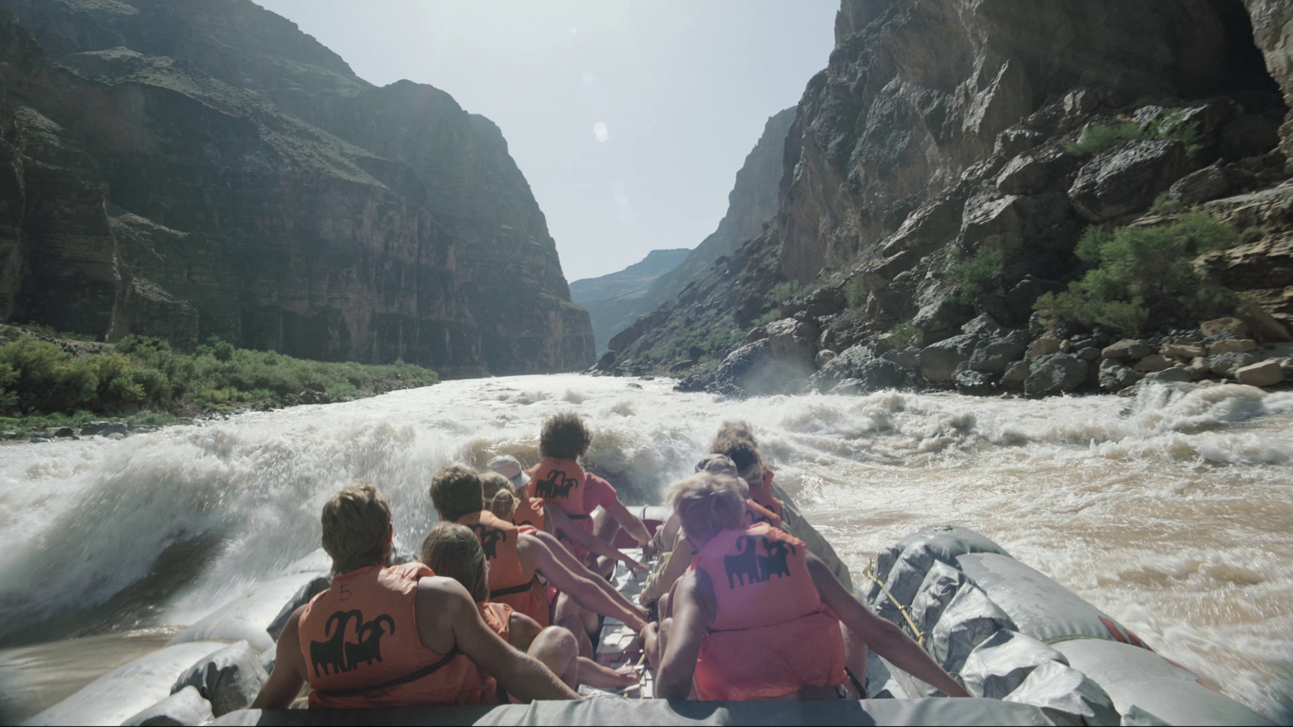
Colorado River conditions are managed by the Bureau of Reclamation through Glen Canyon Dam releases, not by the NPS. River flow levels affect both commercial rafting operations and any hiking routes that pass close to the river. The USGS provides real-time stream gauge data for the Colorado River at the Grand Canyon gauge station, which is the most reliable source for understanding current river conditions. Commercial whitewater operators monitor these releases closely, if you’re booking a river trip, your outfitter will handle condition monitoring, but it’s worth understanding that river levels can change on short notice based on upstream dam operations.
For those drawn to the more adventurous side of canyon exploration, understanding how water and weather interact in the canyon is foundational knowledge. The canyon’s relationship with water, from gentle seeps to dramatic flood events, shapes every aspect of the hiking experience. Those interested in whitewater kayaking in the Grand Canyon understand this relationship at a visceral level, but even hikers benefit from appreciating how water moves through the canyon system.
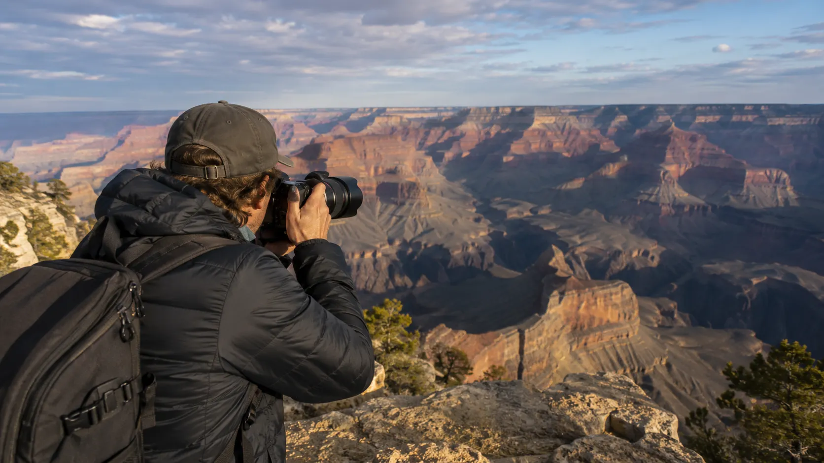
Photography and Viewpoint Access Conditions
Photographers planning specific shots at specific viewpoints need to check both trail conditions to reach those viewpoints and any construction or maintenance activity near popular overlooks. The NPS occasionally closes individual viewpoints for rehabilitation work, and construction scaffolding or barriers can block sightlines at rim overlooks. Check the NPS alerts page specifically for viewpoint-related notices, and call the visitor center if a specific overlook is critical to your plans.
Wildlife-Watching Conditions
Wildlife activity at the Grand Canyon follows its own seasonal patterns, and certain types of wildlife-related closures are separate from trail closures. The park may close specific areas during condor nesting season, bighorn sheep lambing periods, or after unusual wildlife activity near visitor areas. These closures are posted on the NPS alerts page and are generally temporary and very specific in their geographic scope.
Understanding the behavioral rhythms of the canyon’s wildlife, from California condors soaring on thermals to mule deer grazing at rim’s edge, adds an entirely different dimension to reading conditions. Wildlife is often most active in the early morning hours, which conveniently aligns with the safest hiking windows during summer. Knowing the key facts and tips for watching Grand Canyon wildlife helps visitors plan both their timing and their expectations.

Frequently Asked Questions About Grand Canyon Trail Conditions and Closures
Where is the most reliable place to check Grand Canyon trail closures?
The most reliable source is the official NPS Grand Canyon alerts and conditions page at nps.gov/grca. For real-time verbal confirmation, call the Backcountry Information Center at (928) 638-7875. No third-party app or travel website can match the currency and accuracy of these two sources.
How often are Grand Canyon trail conditions updated on the NPS website?
The NPS updates alerts when conditions change. During active events (storms, fires, construction), updates can happen multiple times per day. During stable periods, some alerts may not be updated for several days. If an alert is more than a week old and you’re planning to hike soon, call the BIC to confirm it’s still current.
Can trails close without any advance notice?
Yes. Emergency closures, for rockfall, flash flooding, sudden fire activity, or wildlife incidents, can be implemented within minutes. There is no guaranteed advance notice for emergency trail closures. This is one reason why checking conditions the morning of your hike (not just the night before) matters, and why stopping at the visitor center on arrival is a smart habit.
Is the South Kaibab Trail open year-round?
The South Kaibab Trail is generally open year-round, but upper sections can be icy and treacherous in winter. The trail has no water sources at any point, a critical consideration for any season. During extreme summer heat, the NPS advises against descending South Kaibab after 10 a.m. Check the NPS alerts page for any specific current restrictions.
What does a “Code Red” heat advisory mean for hikers?
A Code Red heat advisory means inner canyon temperatures are forecast to reach or exceed extreme levels (often 110°F or higher at river level). The NPS strongly advises against hiking below the rim during midday hours under Code Red conditions. Rangers may actively discourage or stop hikers at trailheads. This is not a formal closure but is treated as one by experienced canyon hikers.
Does the North Rim close every winter?
Yes. The North Rim closes to vehicle traffic typically in mid-November and reopens in mid-May, dates that can vary slightly year to year based on weather. The North Rim is at a higher elevation than the South Rim and receives significantly more snow. Check the current year’s NPS schedule for exact dates before planning a North Rim visit.
Are there any Grand Canyon trails that require permits?
Overnight backcountry camping anywhere below the rim requires a Backcountry Use Permit issued by the NPS Backcountry Information Center. Day hikes on corridor trails (Bright Angel, South Kaibab, North Kaibab) do not require permits. Phantom Ranch lodging requires advance reservations through a separate system. Permits are separate from entry fees and must be obtained in advance for overnight trips.
How do I find out if a specific viewpoint along Desert View Drive is accessible?
Desert View Drive has its own operating status separate from the main South Rim Village area. Check the NPS roads and parking page for Desert View Drive status, and note that this road has its own seasonal hours (it closes at night during most of the year). Individual pullouts along the drive are rarely closed but can be affected by construction or wildlife activity.
What should I do if I encounter an unexpected closure while on the trail?
Turn back to your last safe point. Do not attempt to bypass closure barriers, even if the reason for closure is not immediately obvious. Report what you saw to a ranger at the nearest visitor facility. If you’re deep in the backcountry and the closure affects your exit route, use your emergency communication device (a satellite communicator is strongly recommended for all backcountry hikes) to contact the park before making any route changes.
Can I get real-time condition updates on my phone inside the canyon?
Cell coverage is extremely limited below the rim and essentially non-existent at canyon depth. Download all condition information, maps, and weather forecasts before you descend. Do not rely on being able to access any website or app once you’re below the rim. A satellite communicator (Garmin inReach or equivalent) provides two-way communication from anywhere in the canyon and is the only reliable communication tool for deep canyon travel.
Do Grand Canyon road closures affect my ability to enter the park at all?
Major road closures on SR-64 can affect entry to the South Rim. Check Arizona DOT road conditions before departure during winter months or storm events. The park has never fully closed due to road conditions alone in modern history, but access can be significantly restricted. The East Entrance via Desert View Drive provides an alternative entry point if the main South Rim entrance is congested.
How does the Grand Canyon Visitor Center in Tusayan help with condition information?
The Grand Canyon Visitor Center and IMAX theater in Tusayan on Highway 64 is the first major visitor facility you encounter before entering the park from the south. Staff there are knowledgeable about current park conditions, can provide orientation information, and can help visitors understand what to expect before they reach the entrance gate. Stopping there before entering the park is especially useful for first-time visitors who want a practical orientation before making decisions about where to hike.
Key Takeaways
- Grand Canyon trail conditions change rapidly, always check official NPS alerts the morning of your hike, not just days in advance.
- Use multiple sources in sequence: NPS alerts page first, then NWS weather (both rim and inner canyon forecasts), then BIC phone call for high-stakes hikes, then recent trip reports for ground-truth detail.
- Hard stops are non-negotiable: formal closures, active flash flood watches, and Code Red heat advisories are not factors to weigh against your hiking ambitions, they are stop signs.
- Download everything before you lose signal. Maps, alerts, water source locations, and weather forecasts must be on your device before you descend below the rim.
- Grand Canyon park conditions vary by zone. Rim conditions, corridor trail conditions, and backcountry conditions are monitored separately and can differ dramatically on the same day.
- A contingency plan is part of your hike plan, not an afterthought. Know your alternates before you arrive, and brief your group on them.
- The Backcountry Information Center is the most underused resource available to Grand Canyon hikers. A 10-minute call can provide information no website currently has.
- Guided tours eliminate condition-monitoring uncertainty for visitors who prefer to experience the canyon without the research burden, professional guides maintain real-time awareness of conditions and adjust routes accordingly.
- Grand Canyon road closures affect trailhead access as much as trail closures themselves, always check SR-64 and shuttle status before departure.
About the author
Explore The Canyon Editorial Team
See The Canyon


